
INCA
The Inca civilization emerged from fragmented independent societies by ca. 1000 AD (D’Altroy, 2003). The extent of the Inca Empire included parts of modern day Columbia, Ecuador, Peru, Bolivia, Chile, and Argentina. The small city-state of Cuzco became the capital under the rule of Pachacuti Inka Yupanki and represented a center of Tawantinsuyu (The Four Parts Together), i.e. the Inca Empire.
The Inca Empire was short-lived (lasting a little more than a 100 years) before collapsing as a result of the Spanish invasion. During this short time period they were able to accomplish a great deal in architecture, engineering, and agriculture.

General map of the Machu Picchu and Cuzco areas showing location of the Sacred Valley of the Inca(copyright with Dr. Yuri Gorokovich)
The area around Cuzco contains numerous historical sites with examples of water technologies. Pachacuti Inca Yupanqui and his sons designed and implemented water irrigation channels around Cuzco including fountains and culverts for springs. He built Tambo Machay, a spring shrine type structure which according to Spanish historian Bernabé Cobo served as a lodging for Pachacuti when he went hunting (Hemming, 1982). Both, Tambo Machay and nearby Puca Pucara are huacas (“sacred things” or “anything in nature that is out of the ordinary”), that served primarily for religious services and worships (Bauer, 1998).
The Inca had a remarkable knowledge of engineering as evidenced by their roads, bridges, water systems, irrigation systems, and agricultural systems. The Inca road system was massive and elegant covering much of the Andes from the present day borders of Columbia and Ecuador to south of Santiago, Chile. This was the most extensive ancient construction in the Americas with approximately 23,000 km (nearly 13,000 miles that can now be charted) and possibly may have been twice as large. The massive road system of the short-lived Inca Empire obviously was based upon not only the new construction of roads, but also some roads built by the pre-Inca.
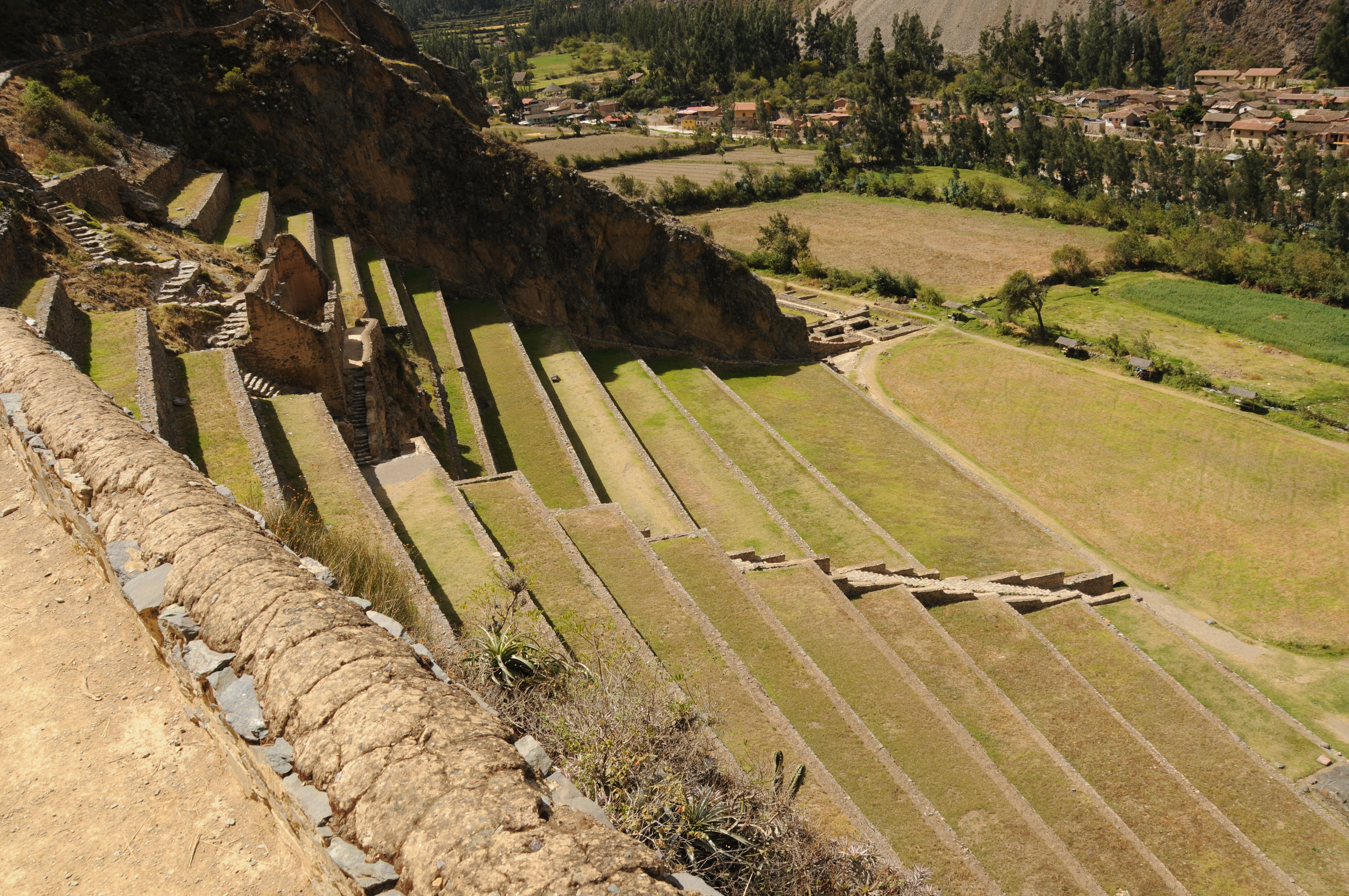
The Incas practiced the art of agriculture carrying it to a “remarkable extreme” (Bingham, 1948). They understood the cultivation of soil, irrigation of crops, agricultural drainage, fertilization of crops, and soil conservation using terraces (terrace agriculture) in most agricultural fields in the Peruvian Andes. Pisac, developed as an estate for Inca royalty is one of the most spectacular examples of Inca agricultural practices.
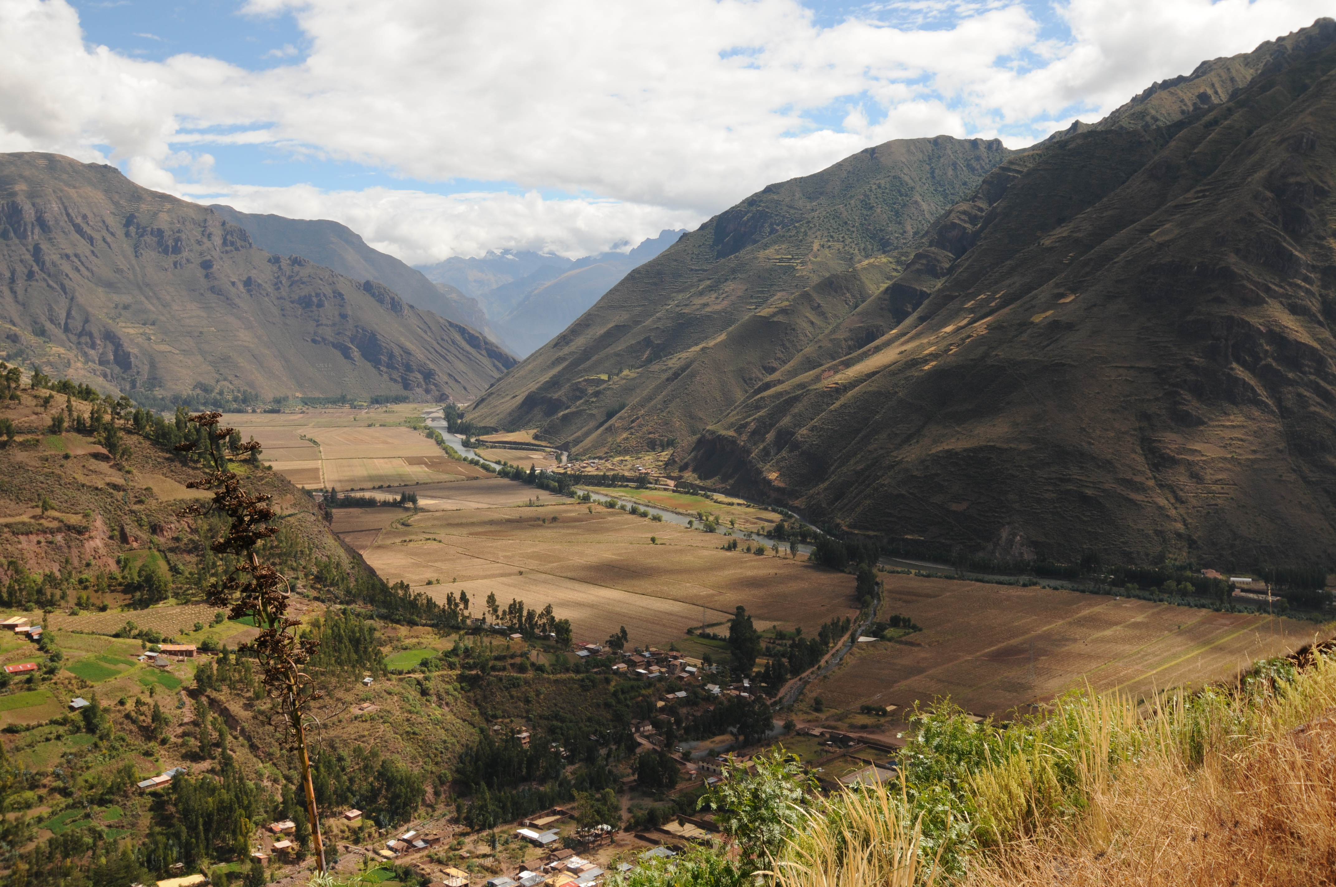
Sacred Valley near Pisac

Condor Mountain above town of Pisac showing the agricultural terraces.
Machu Picchu, Peru

Machu Picchu showing the Urubamba River below that circles around Machu Picchu. The taller mountain peak of Huayna Picchu and shorter peak of Una Picchu.

Another view of the urban area of Machu Picchu.

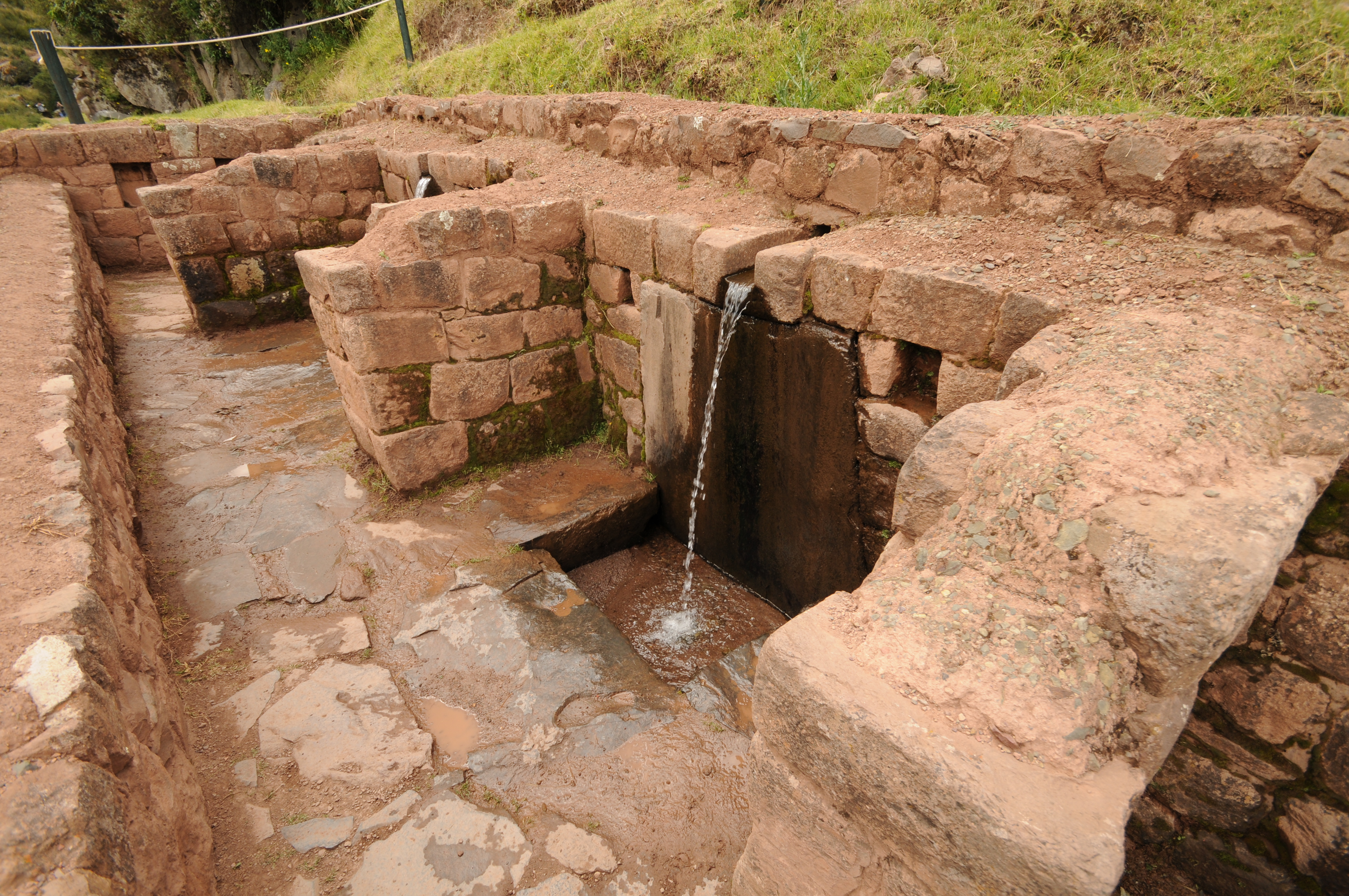
Aqueduct channel flowing to fountains.
Aqueduct channel into flowing to fountains.
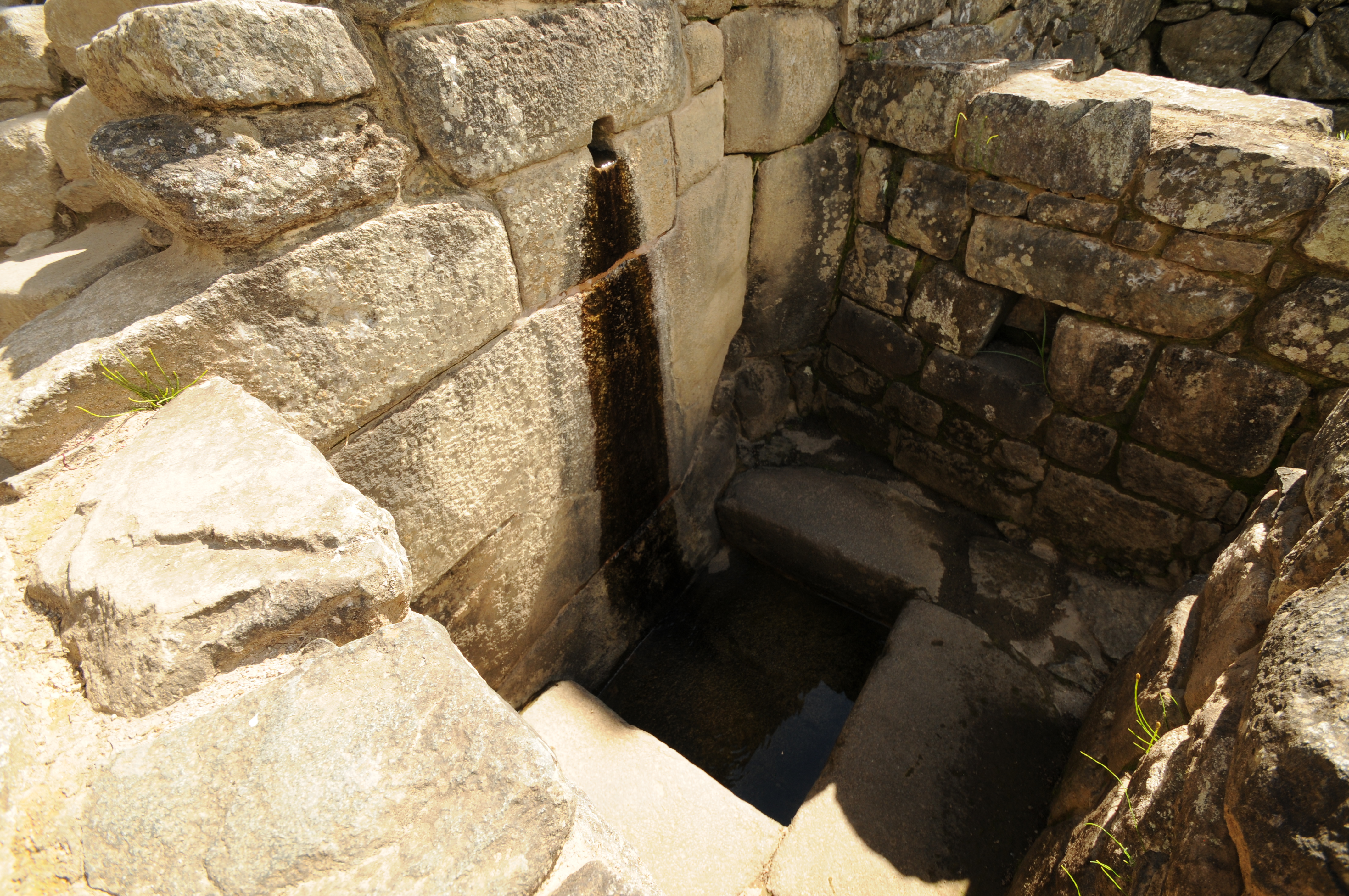
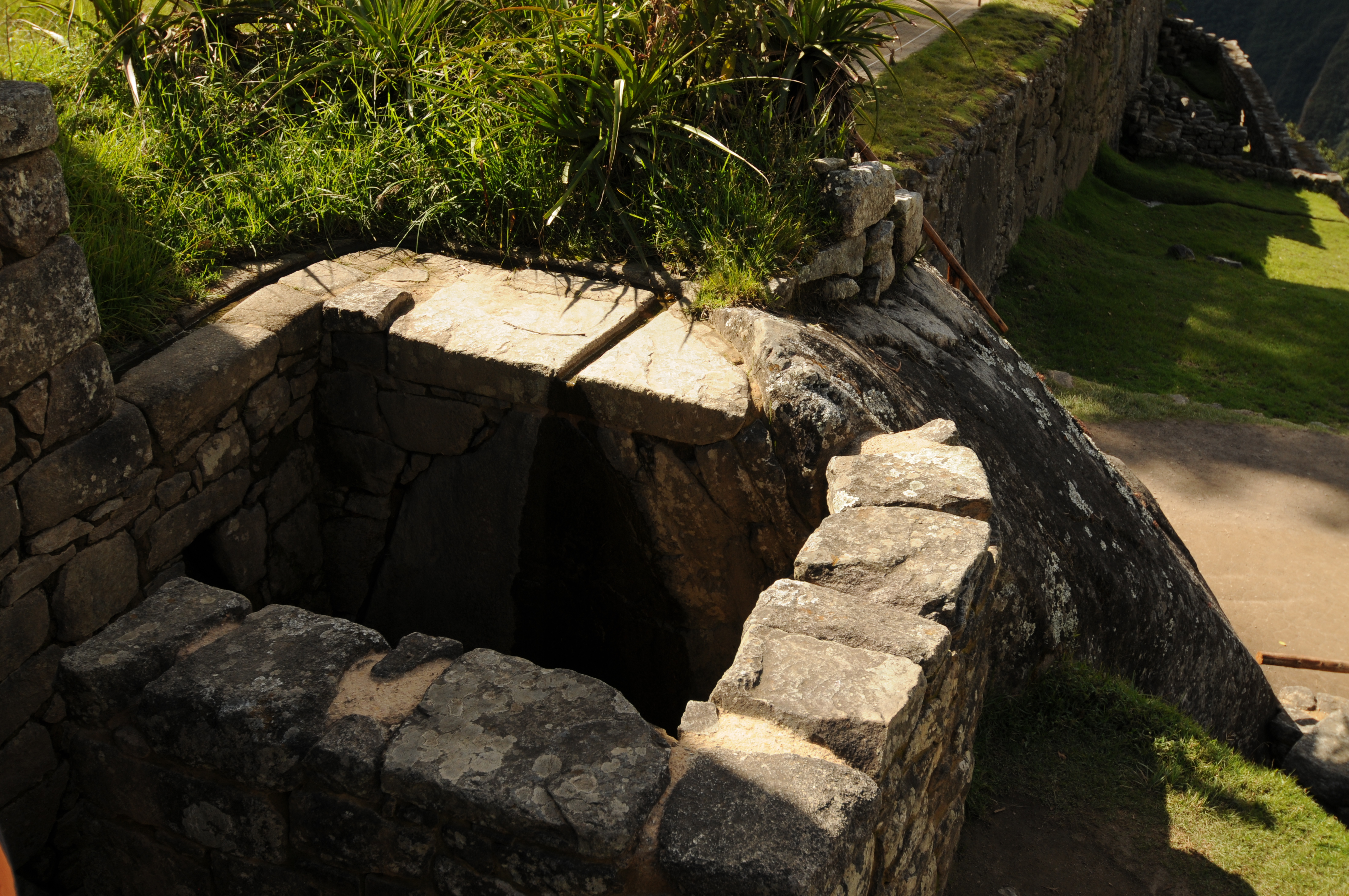
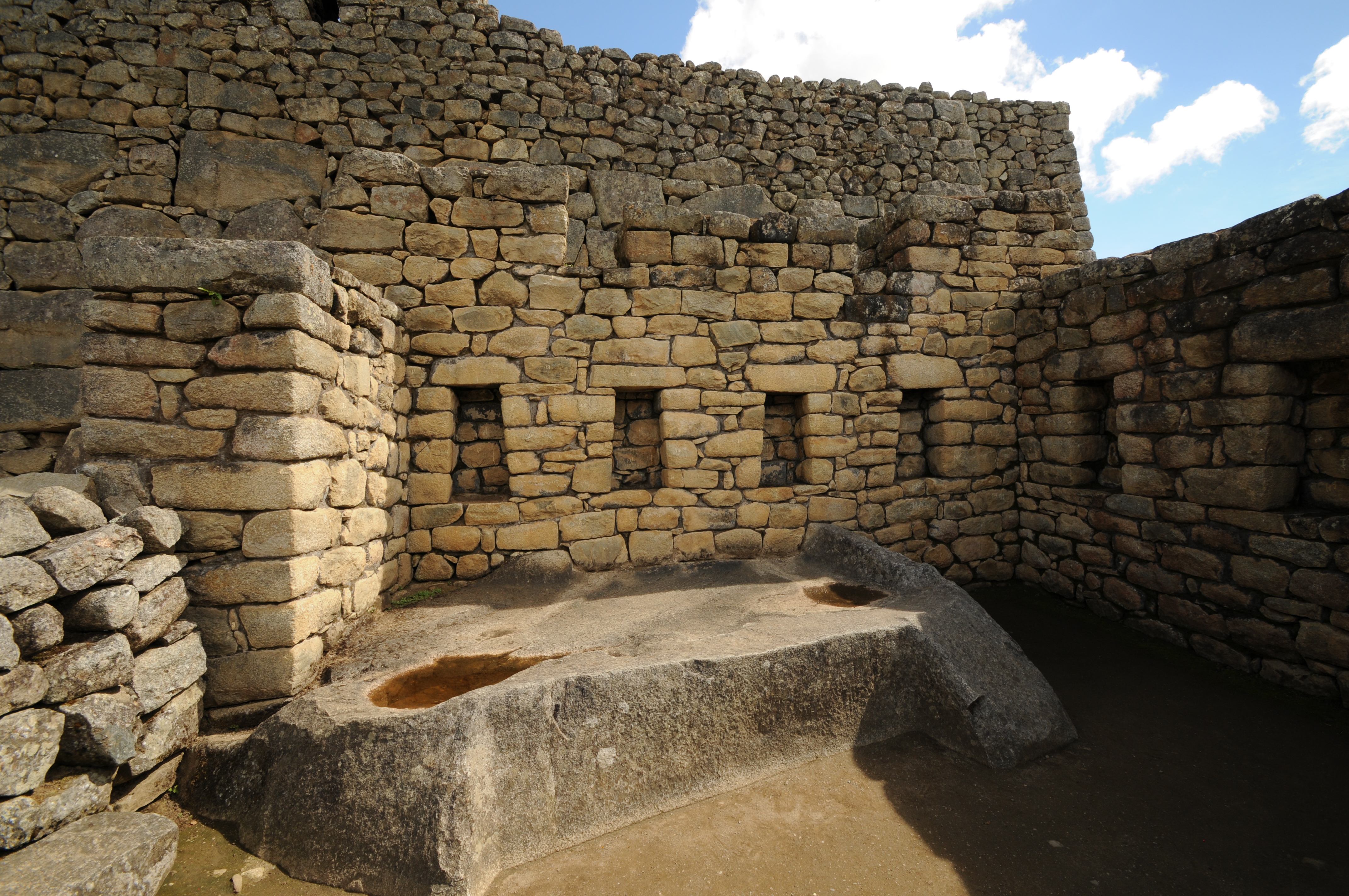
Fountain

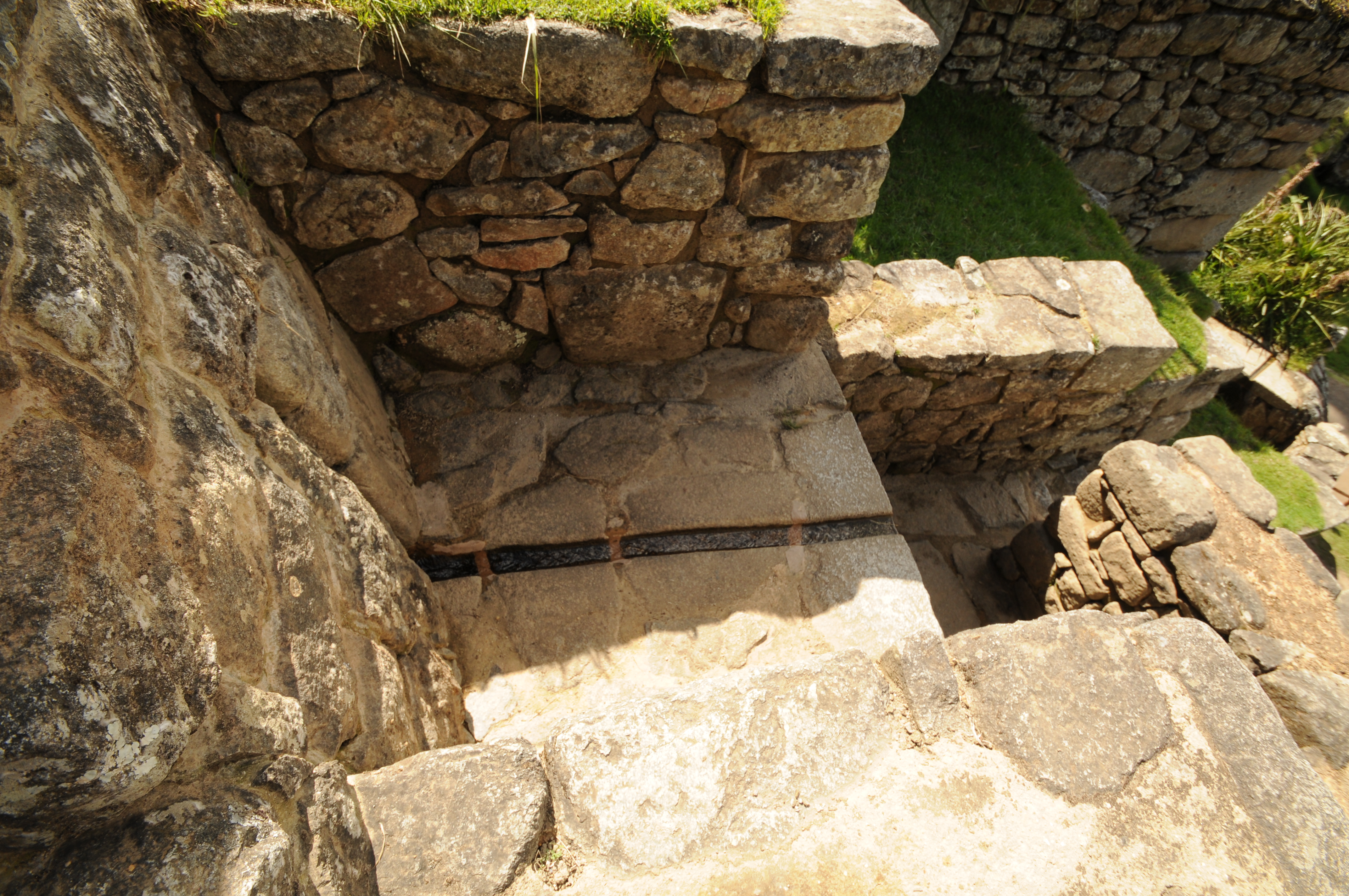

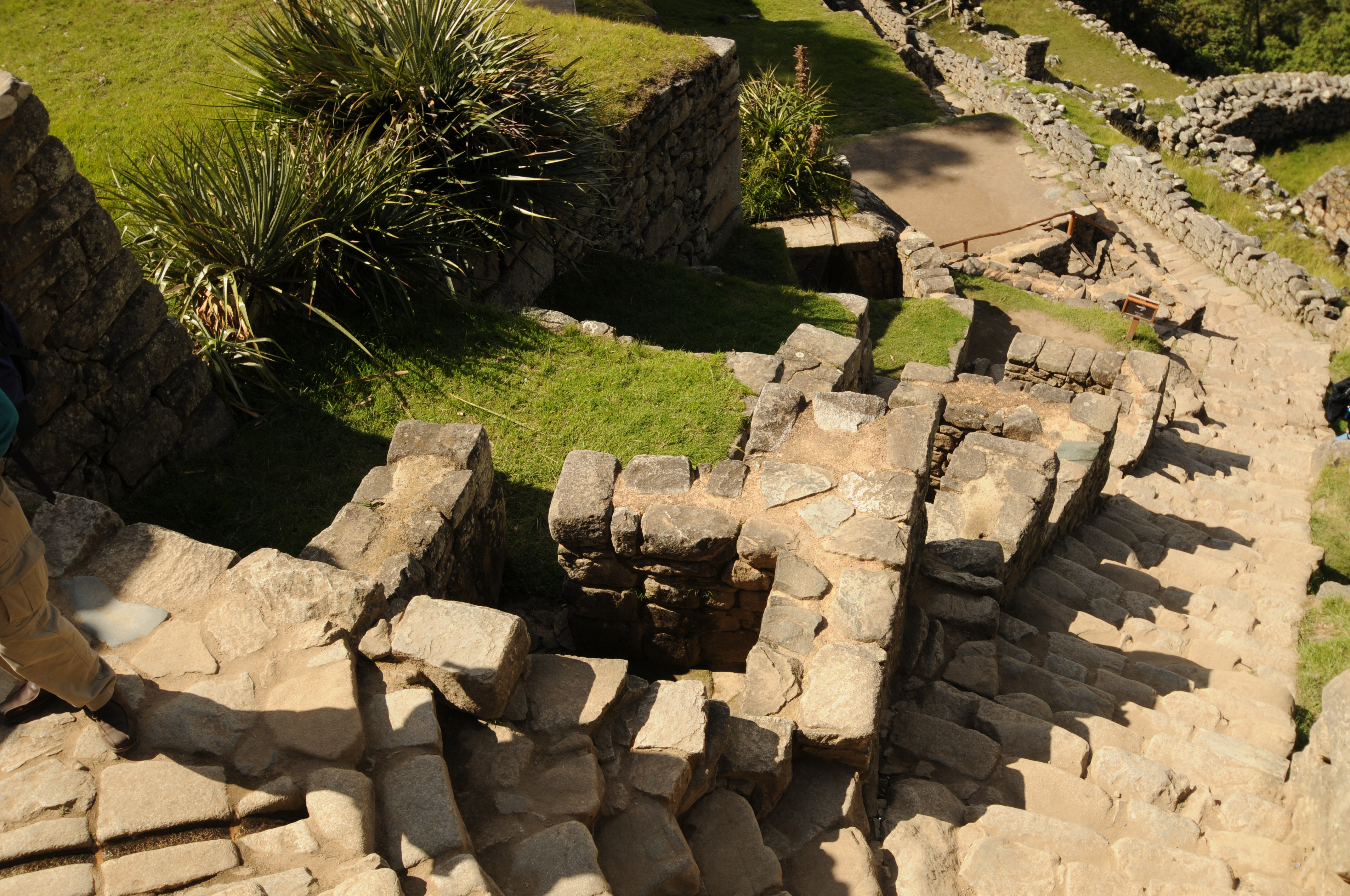
Stairway along fountains.
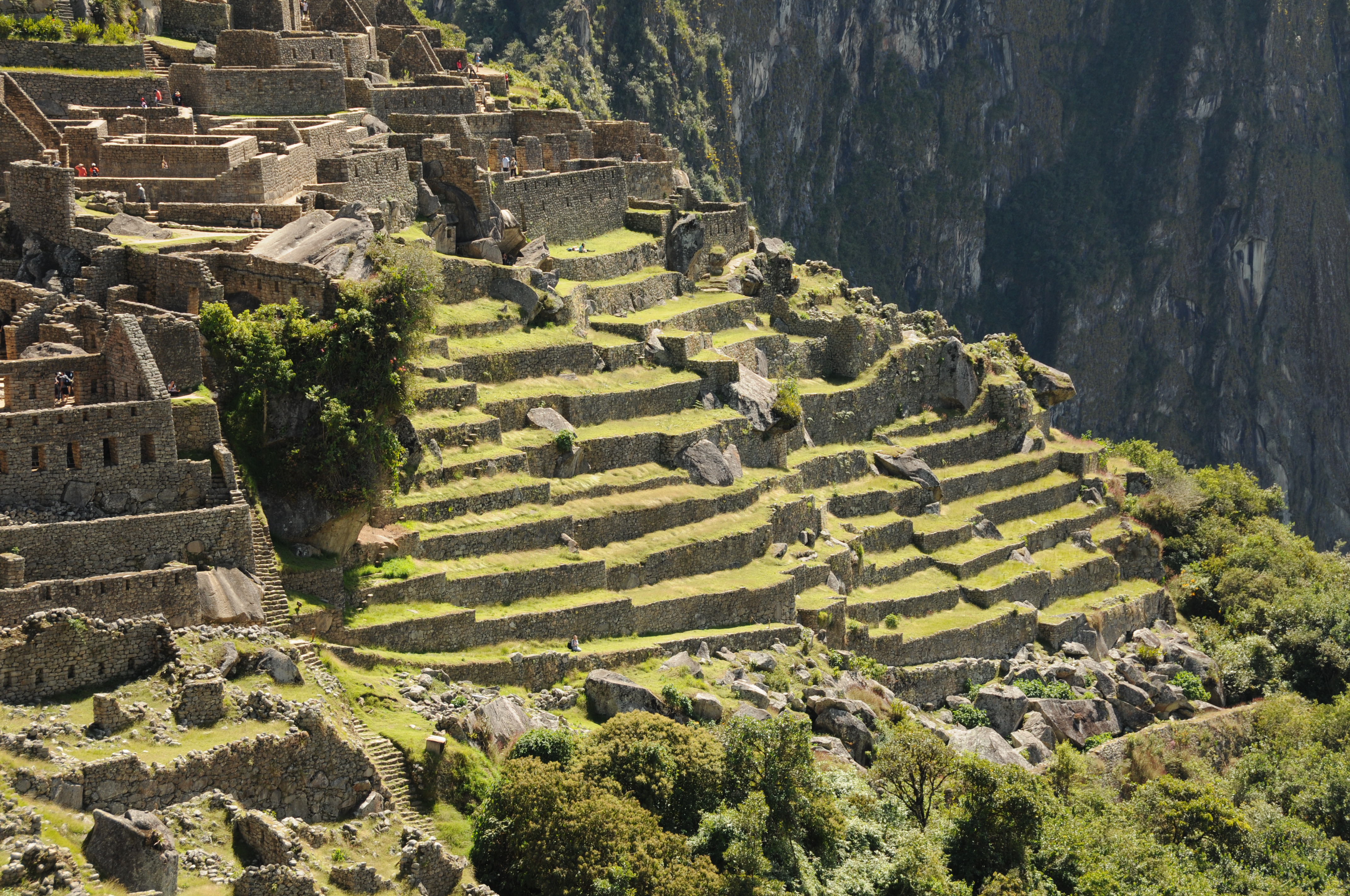
Terraces

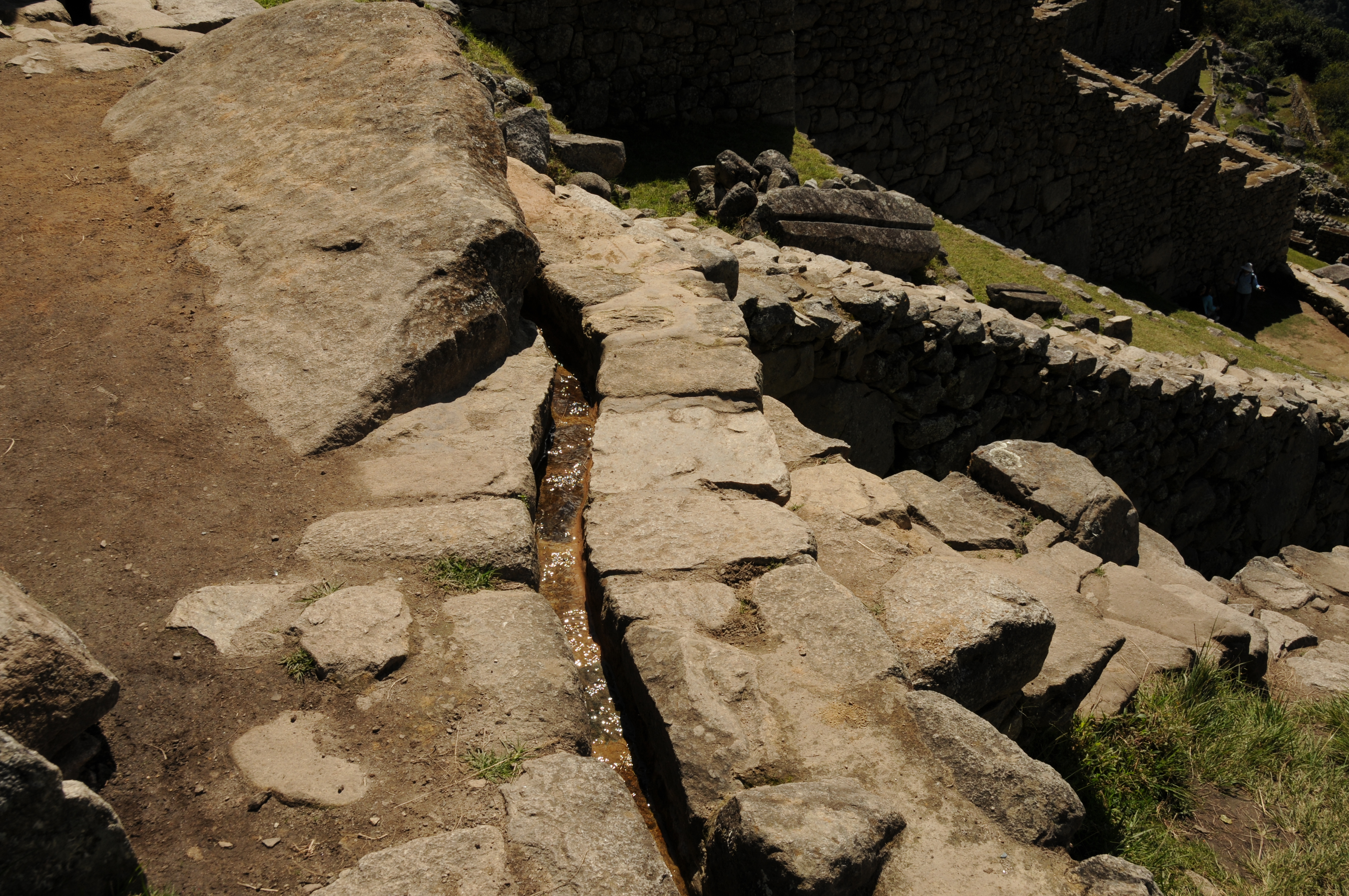
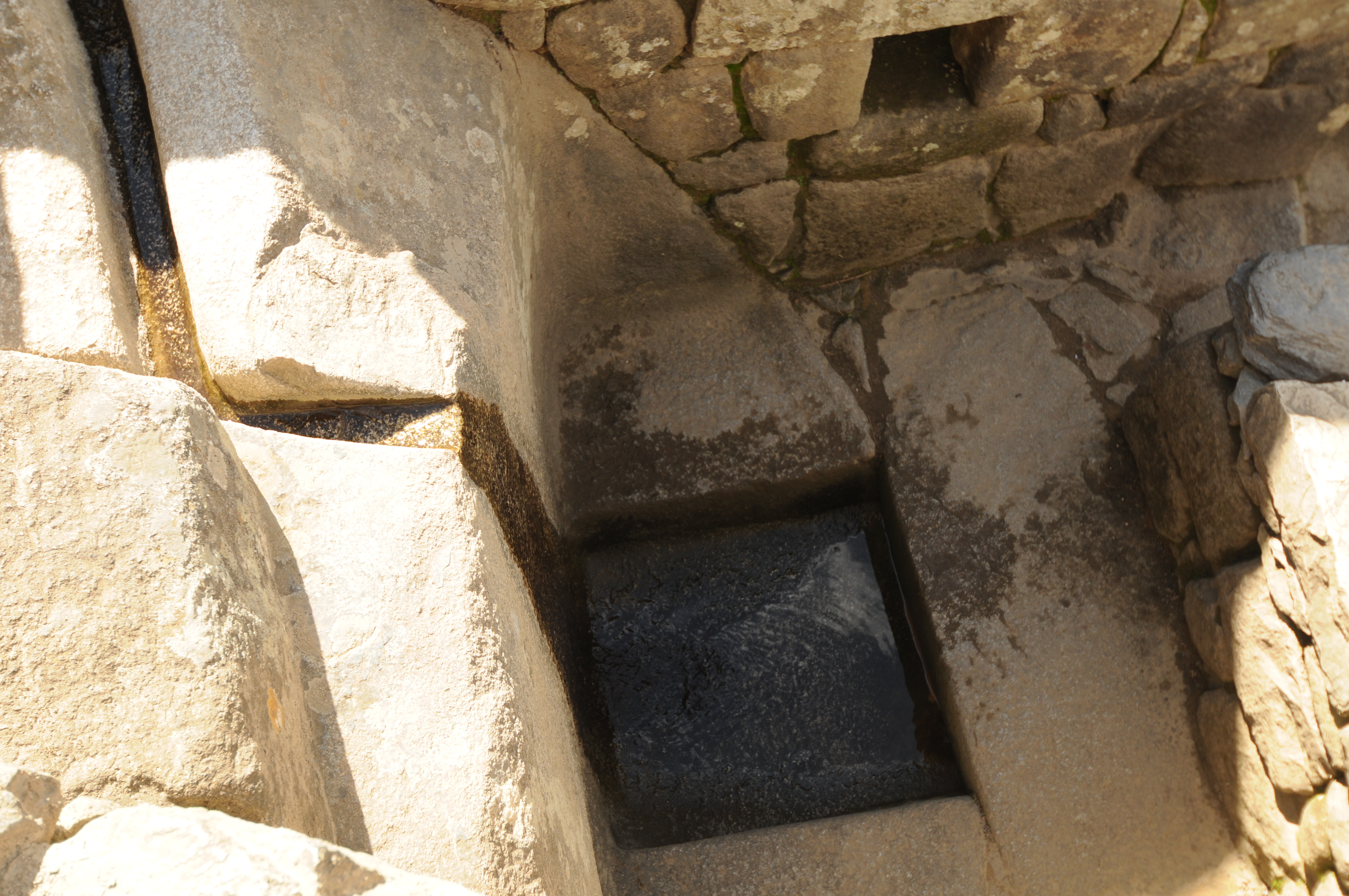
Main Drain

Smaller drainage channel
Temple of the Sun at Machu Picchu

Looking down into the Temple of the Sun (with the curved wall), encloses the rock huaca. Also shown is the window above the Royal Tomb.
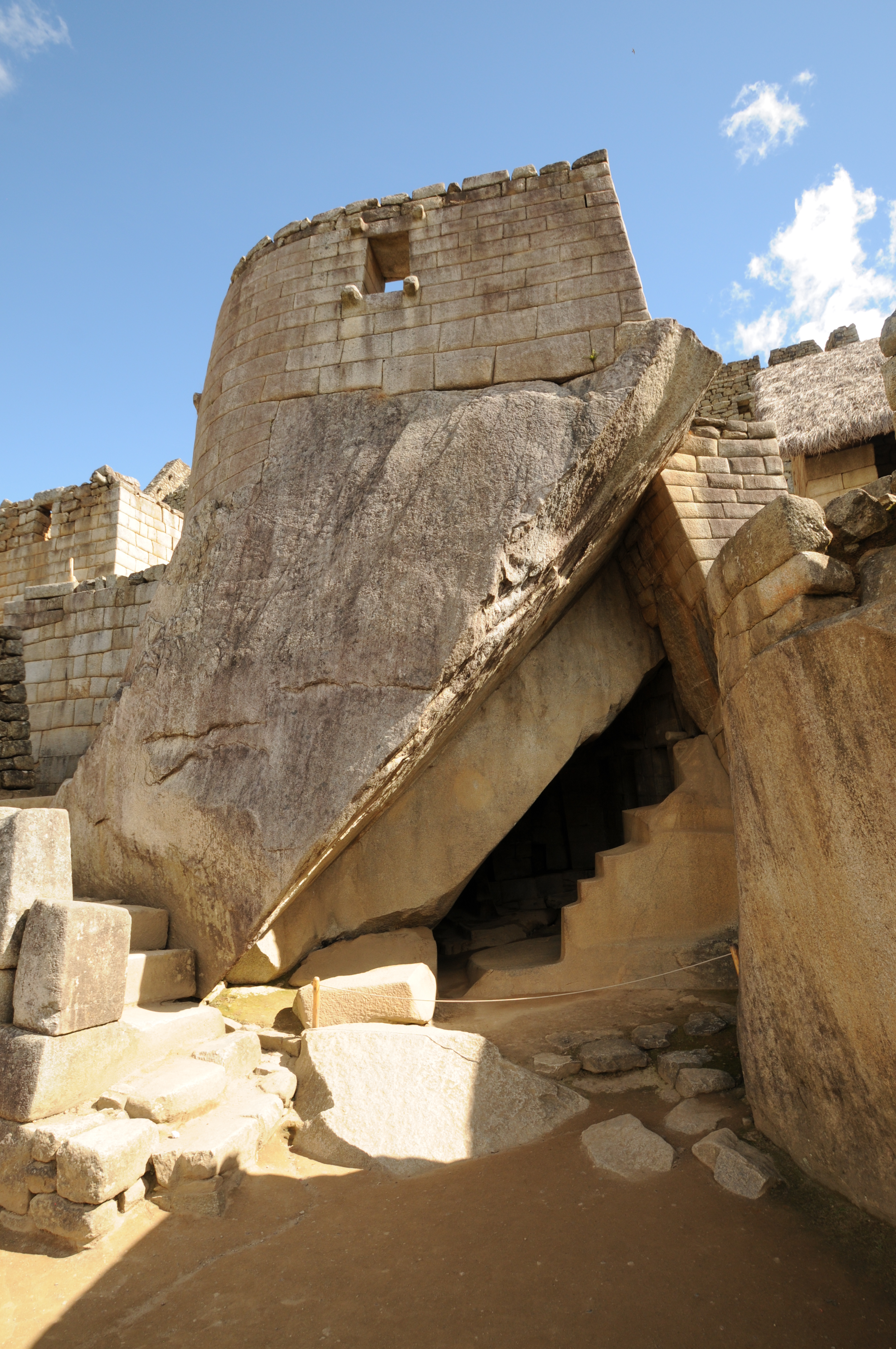
The Temple of the Sun at the top has the curved wall and as shown was built on a huge outcrop of granite. Under the Temple is the Royal Tomb with the shaped stone that look like steps.

Representing the interior world are the sculpted stairs that sing, located below the Temple of the Sun at Machu Picchu.
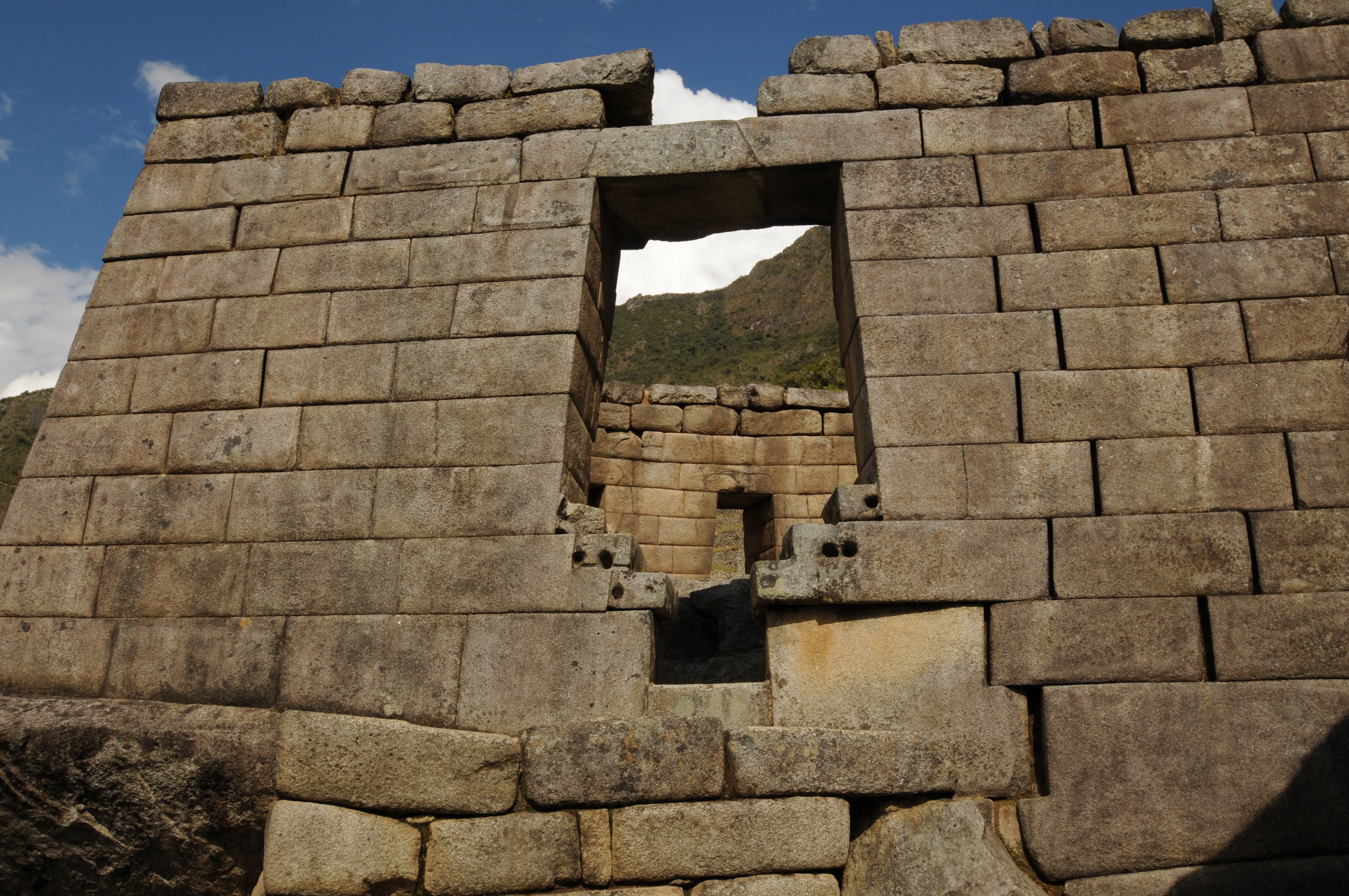
This window in the wall of the Temple of the Sun overlooks the third fountain from the top fountain of the 16 fountains. Note the unexplained small holes in the stones near the bottom of the window.

Note the type of architecture that would have thatched roofs.

Grain warehouses near the main entrance to Machu Picchu. Note the thatched roofs that were attached using eye-anchors and roof pegs as first described by Bingham (1912).

Rock with carved channel that may have been abandoned.
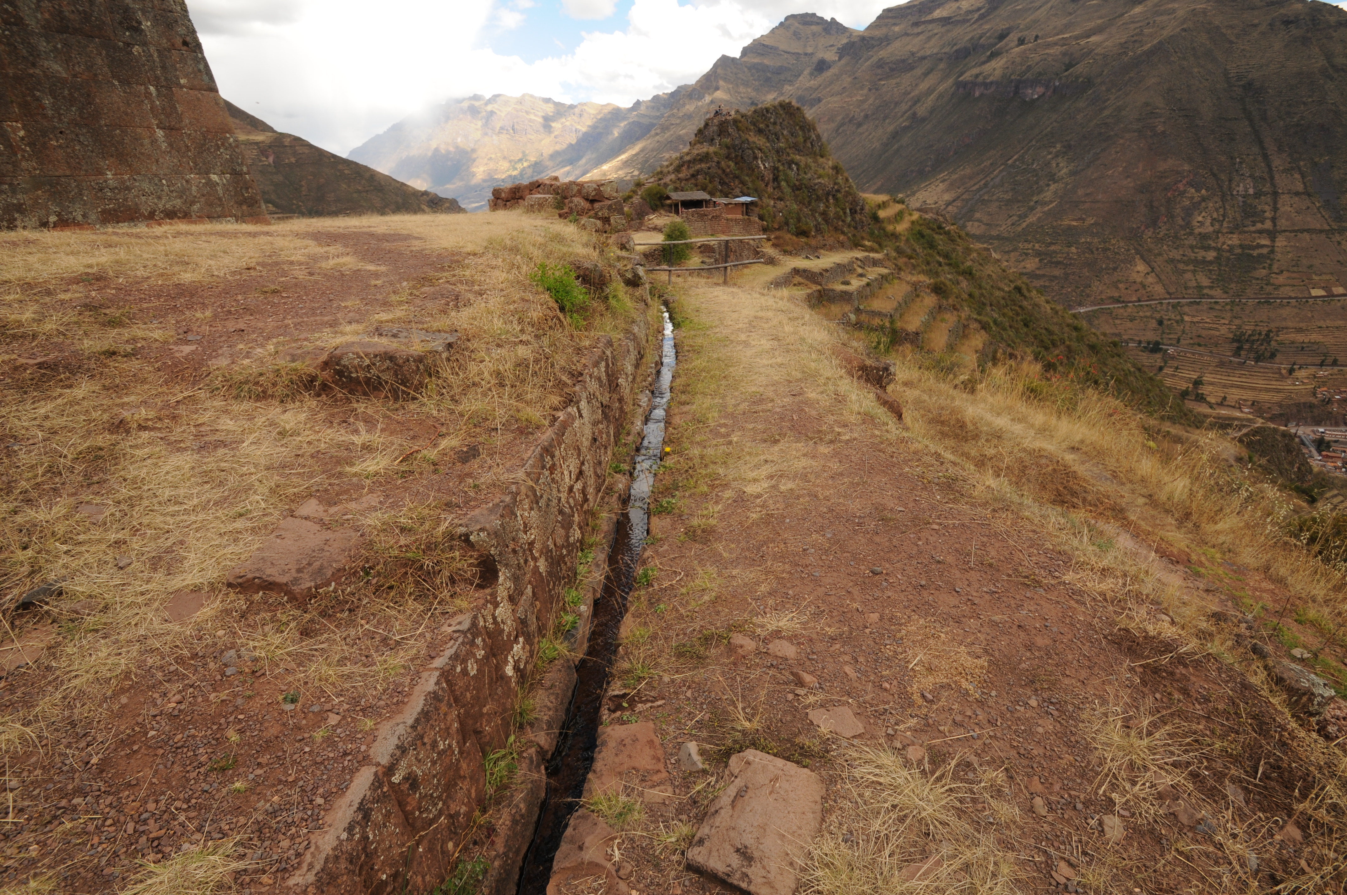
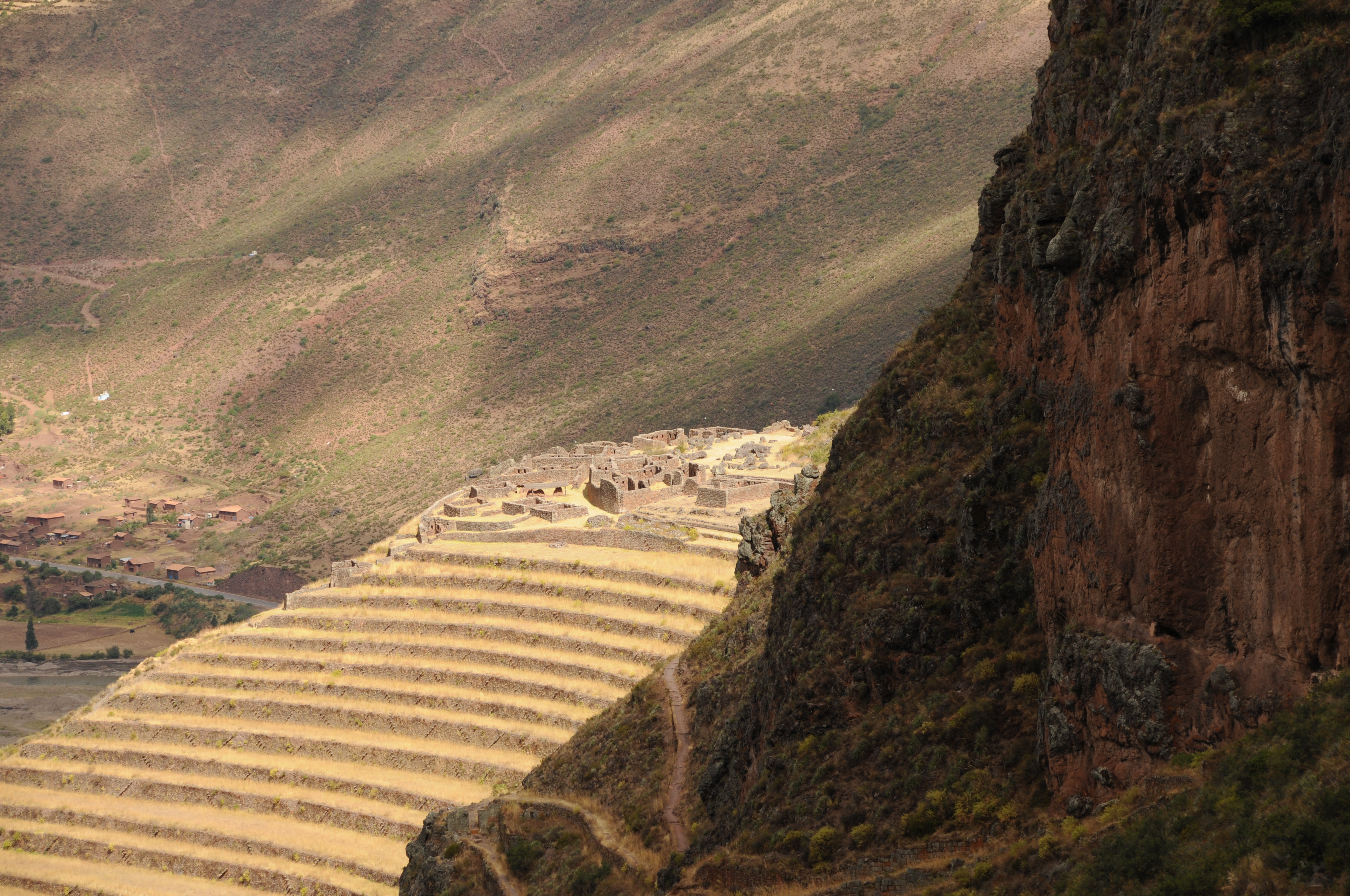
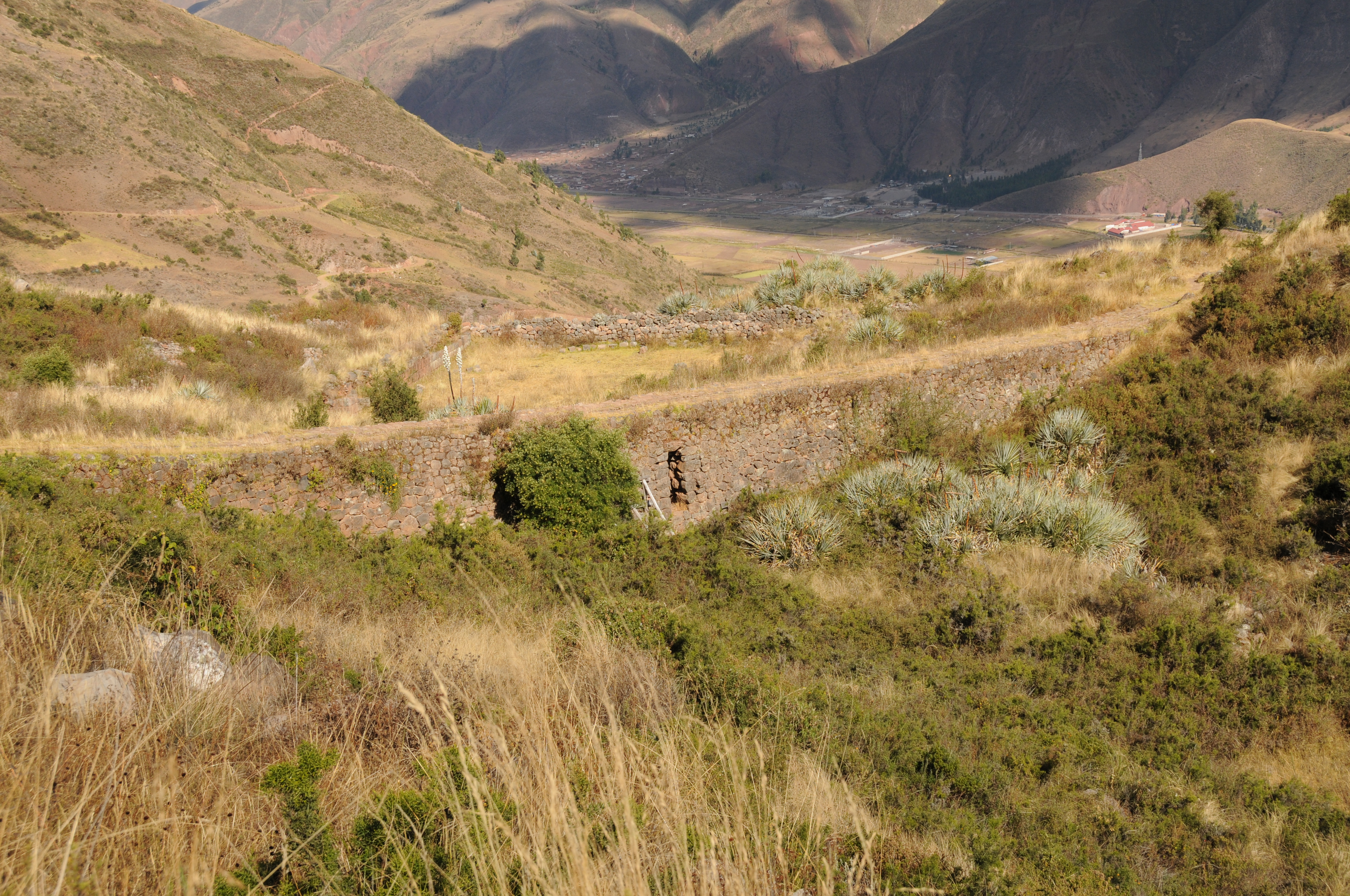
Pisac
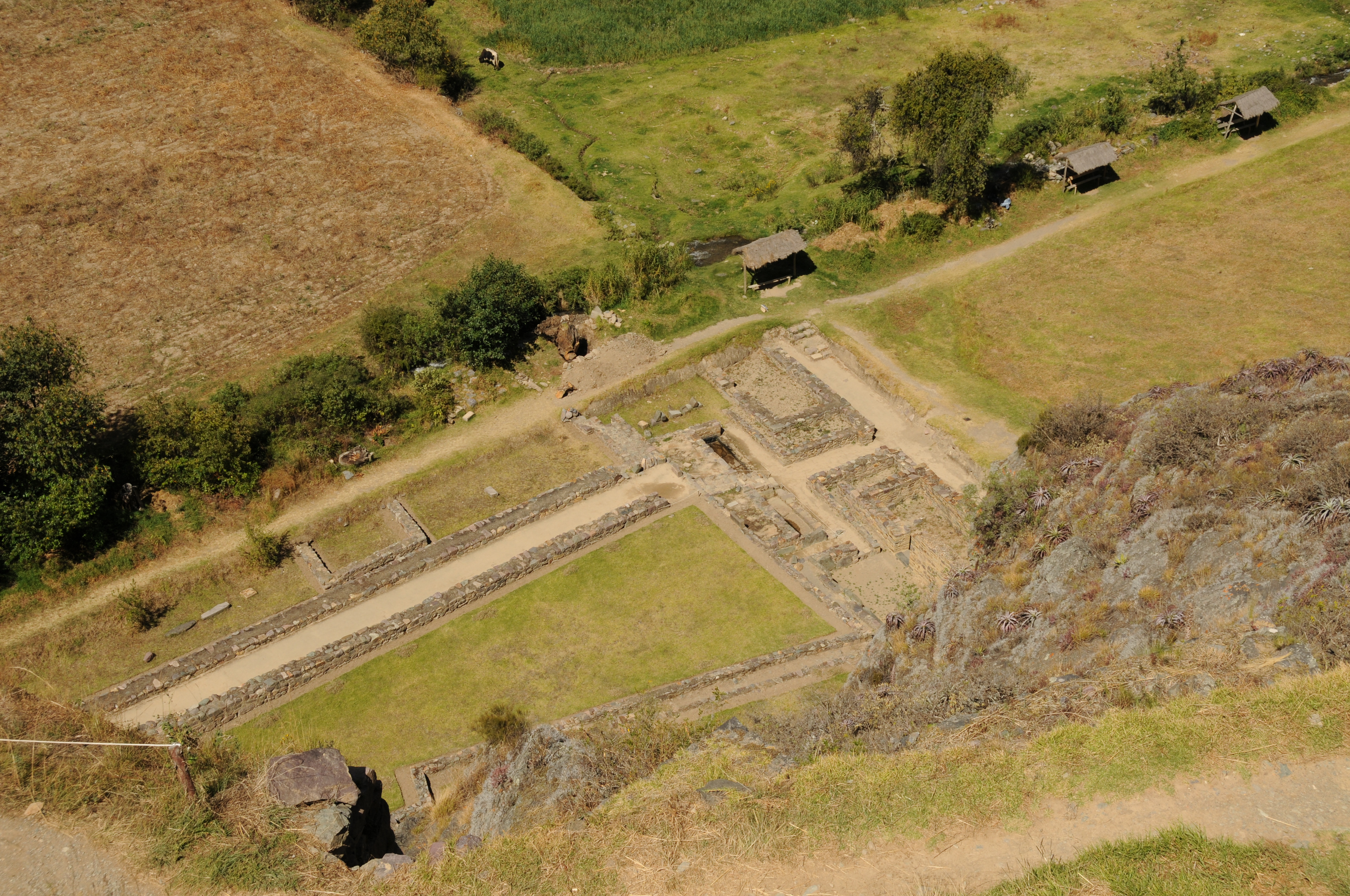
Pisac is one of the closest major ruins to Cuzco located in Yucay Valley near river Vilcanota at elevation of 3400 m. Its history and origin are almost absent from chronicles, except from few notes by Sarmiento de Gamboa in his description of the valley of Pisac (Hemming, 1982). It is possible that this was a place visited by Pachacuti Inca Yupanqui for pleasure but no historical documents reveal its history and origin. Some architectural evidences, such as gates, defensive walls and stone pegs for doors show a possible military role of Pisac. The site structures are scattered along the mountain side and consist of granaries, living quarters, fortified barracks and series of beautiful agricultural terraces with irrigation channels.
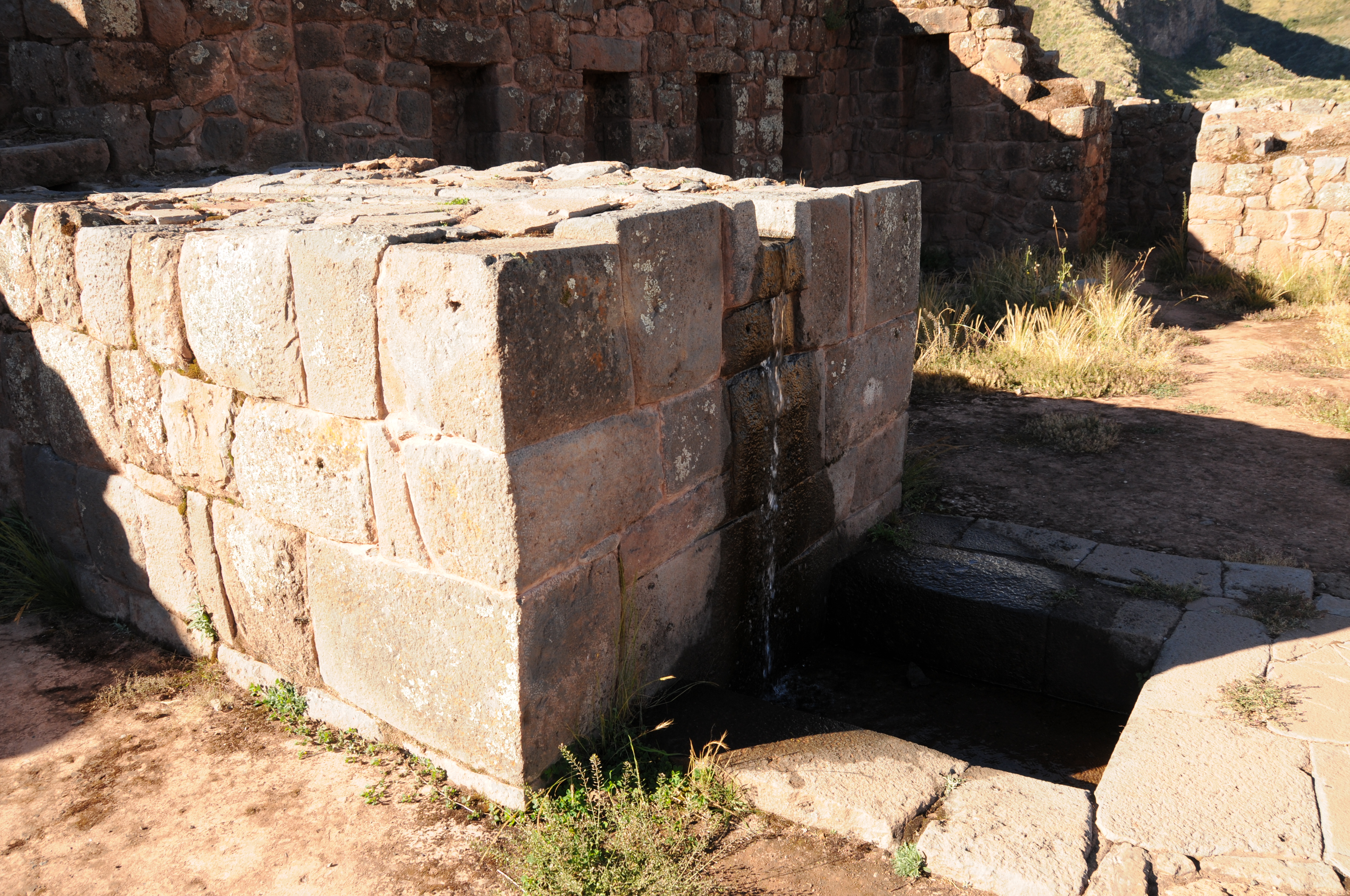
The water use in Pisac was mainly for irrigation and religious services. The central inti-huatana (The Temple of Sun) in Pisac is surrounded by walls and has few baths and a water channel. The water channel comes out of the western side of the mountain and is about 20-25 cm wide. It is hard to reconstruct the original water works structure because extensive restoration projects at Pisac “mask” ancient remnants with more pleasing appearance that is catered for tourists.

Agricultural terraces at Pisac which was developed as an estate for Inca royalty is one of the most spectacular examples of Inca agricultural practices.

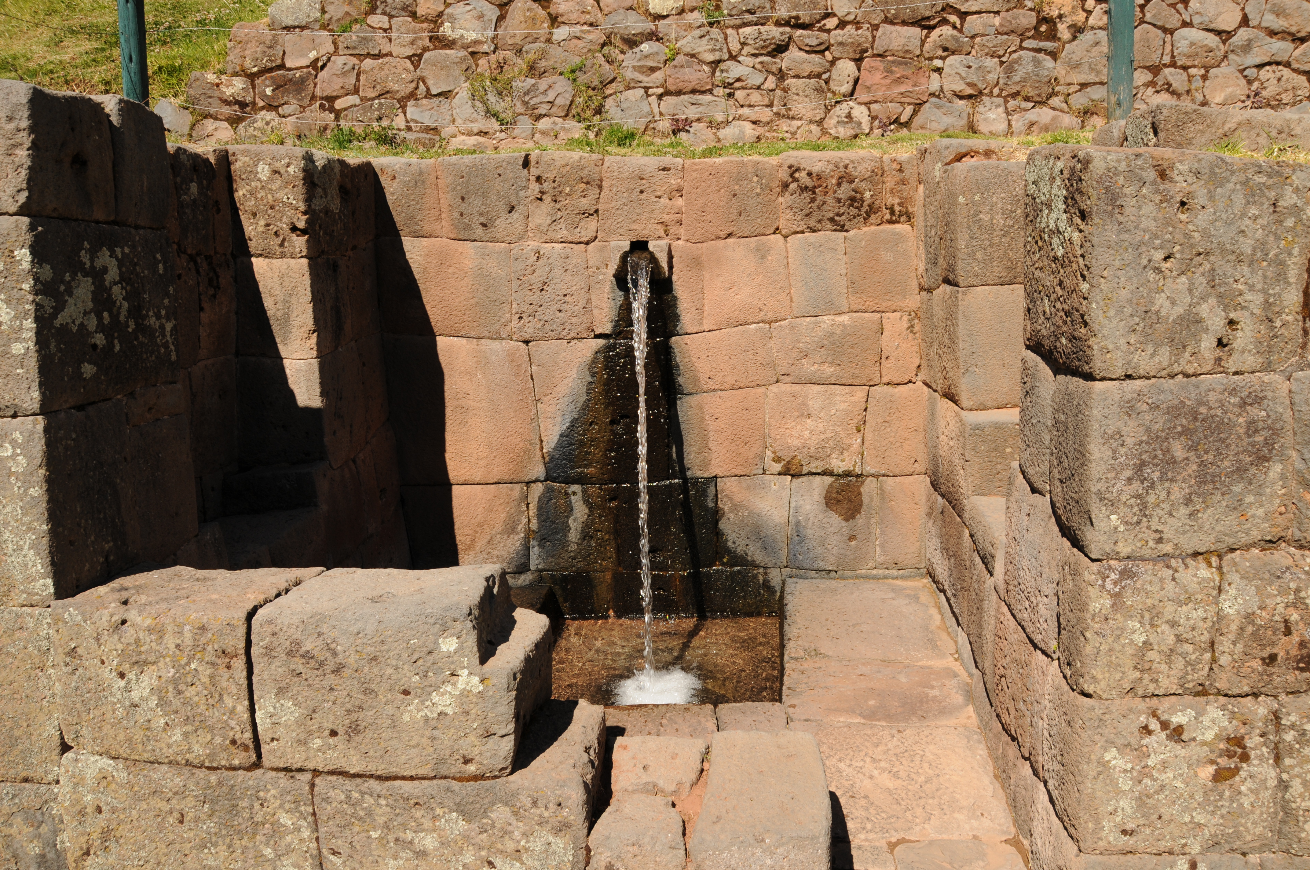
Agricultural terraces and fountains to the right
Fountains

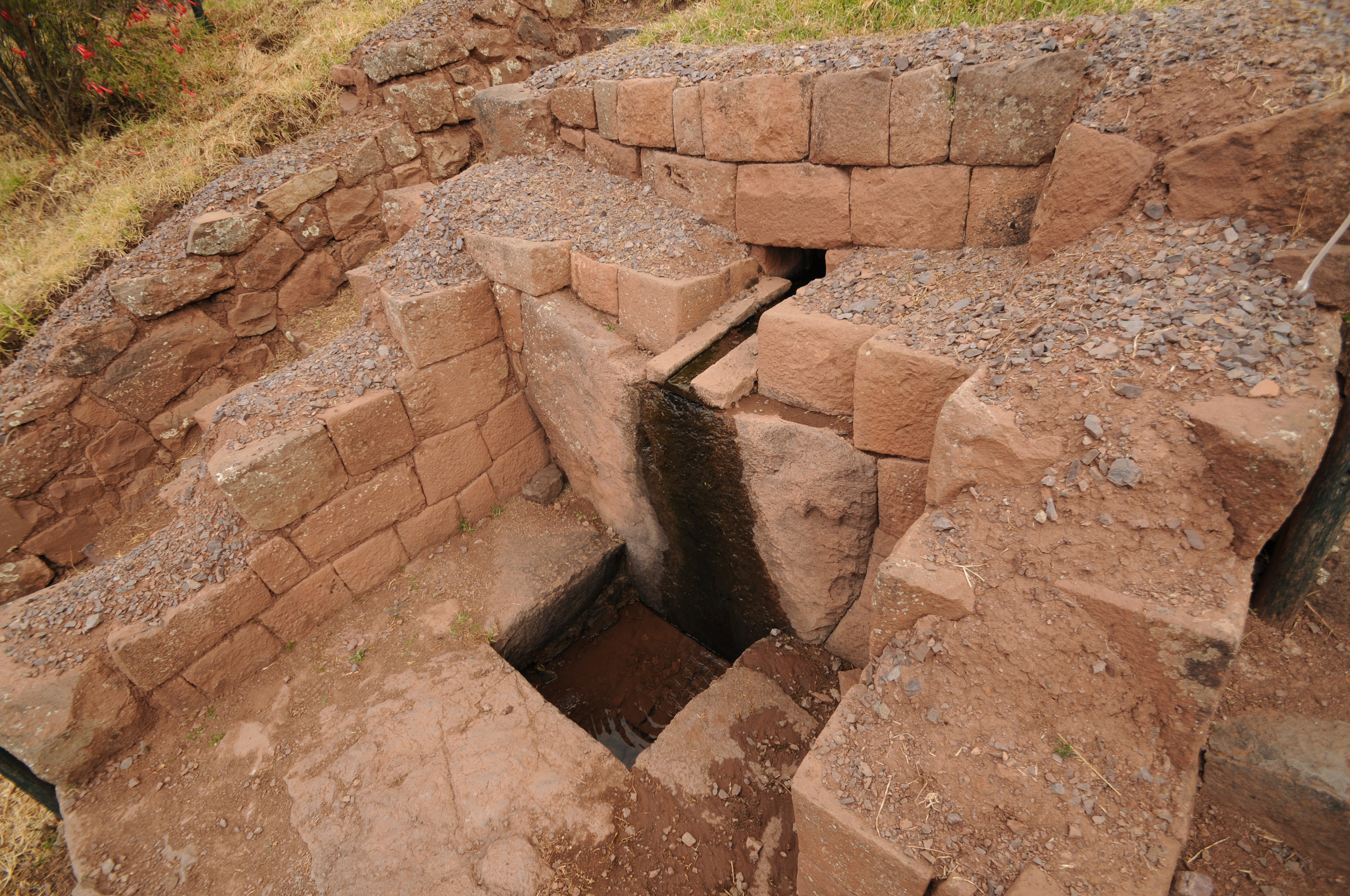
Fountains with channel below

Water channel below fountains and steps
Water channel

Central Inti-huatana shown in the curved wall area.

Fountain near

Channel downstream of fountain

Channel flowing into ritual bath

Location of fountains downstream of the ritual bath


Terraces
Tipon
Tipon is located 23 km southeast of Cuzco at an elevation of 3560 m above mean sea level. It is made up of 12 terraces that are flanked by stone walls. In Tipon water was diverted from the Rio Pukara for irrigation and domestic supplies. Three irrigation canals (aqueducts) diverted water upstream of Pukara, approximately 1.35 km north of Tipon’s central terraces. The main aqueduct diverted water from the river at an elevation of 3690
m.
Several fountains were built Tipon. The principal fountain received water from the main spring near the top of the terraces. This fountain provided domestic water supply
for the noble residents prior to use of the water for any other purpose. Another fountain which supplied water for ceremonial purposes and for domestic water was located on the side of one of the terraces. This fountain received water from a canal through an approach channel and conduit, then dropped into a stone basin. The unused water flowed into another downstream canal that conveyed the water. A fountain also was built in the Ceremonial Plaza.
The Central Terraces of Tipon

Bottom of terraces and entrance to Tipon

Central terraces

Hydraulic drop structures near middle of central terraces.

Terraces walls showing arrangement of steps from terrace to another. Note the proximity to the hydraulic drop structure.
Ceremonial fountain along terraces
Spring with fountains below looking down the central terraces.
Channels below springs that flow to fountains

Above fountains showing diversion structure for fountains
Upper two fountains

Lower fountains

View from below fountains
Channel along terraces

Channels along terraces
Ceremonial Plaza of Tipon

Principal aqueduct channel from the Rio Pukara for irrigation and domestic supplies

Bend in aqueduct channel from Rio Pukara.

Principal aqueduct channel from the Rio Pukara
Aqueduct bridge of principal canal from the Rio Pukara
Fountain in Ceremonial Plaza

Fountain in Ceremonial Plaza

Fountain in Ceremonial Plaza
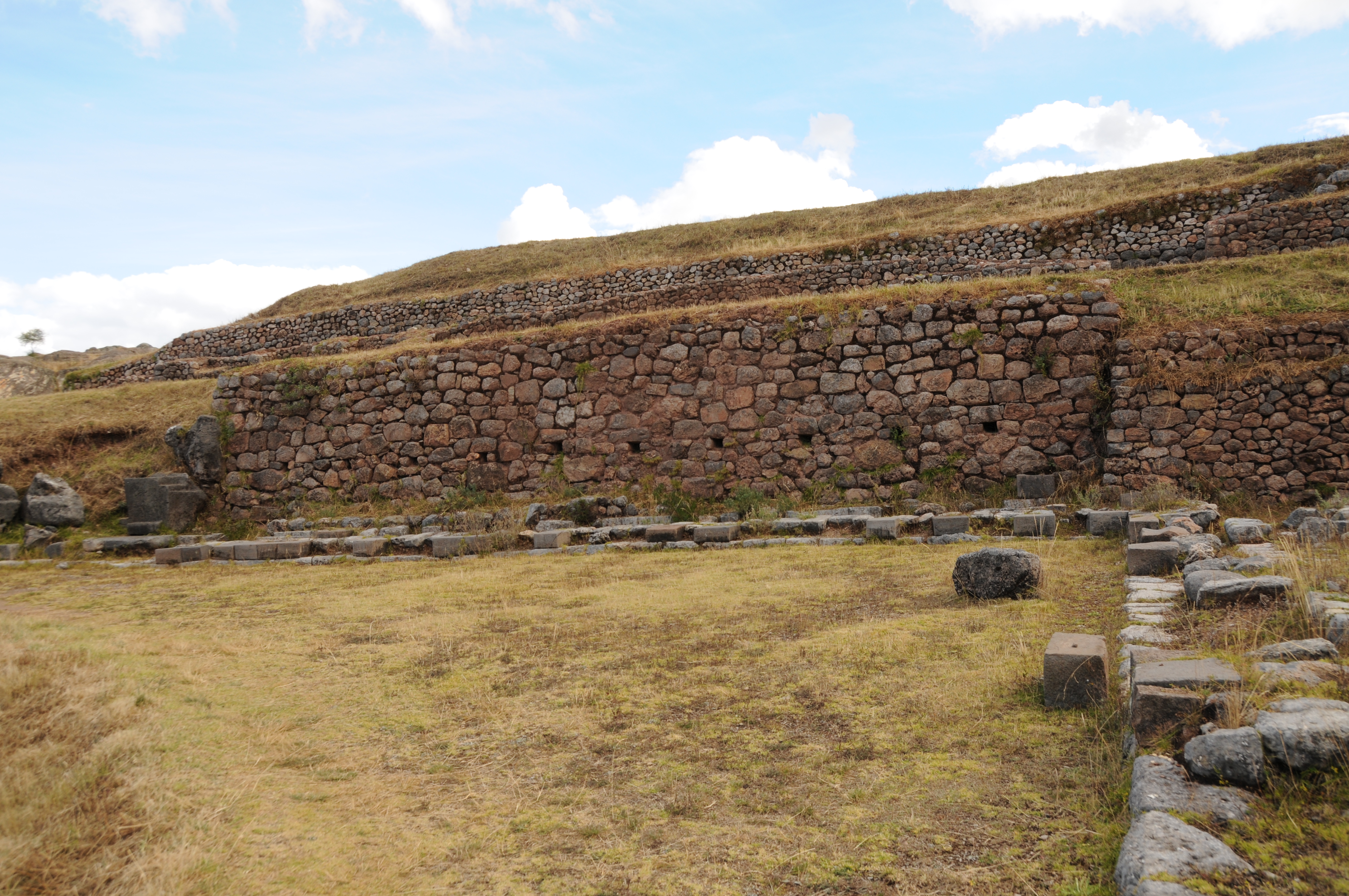
Tambo Machay
Tambo Machay (“resting place” or “resting cave”) and Puca Pucara (“red fortress) are located within the walking distance from Cuzco and within 500 meters from each other, separated by the main road from Cuzco to Pisac. Comparing to Machu Picchu, Pisac and Tipon they represent water use technologies on a much smaller scale. Both, Tambo Machay and Puca Pucara have stone fountains with dual channels.

Fountain area at Tambo Machay.

Close-up view of the fountain at Tambo Machay with two channels to produce two water fountains. Flowing water and duality were both important elements in Inca beliefs. Also shows channel below fountain.

Another fountain at Tambo Machay.
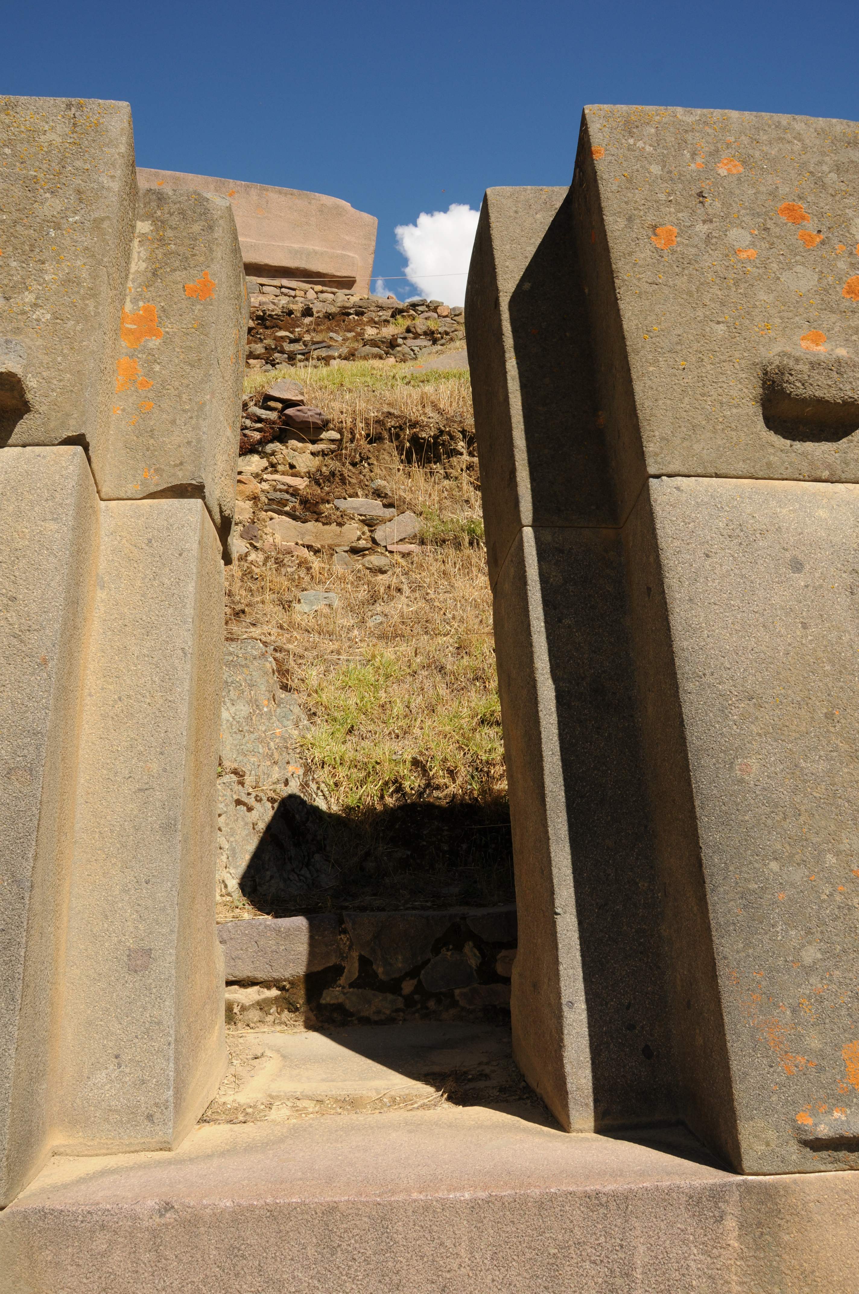
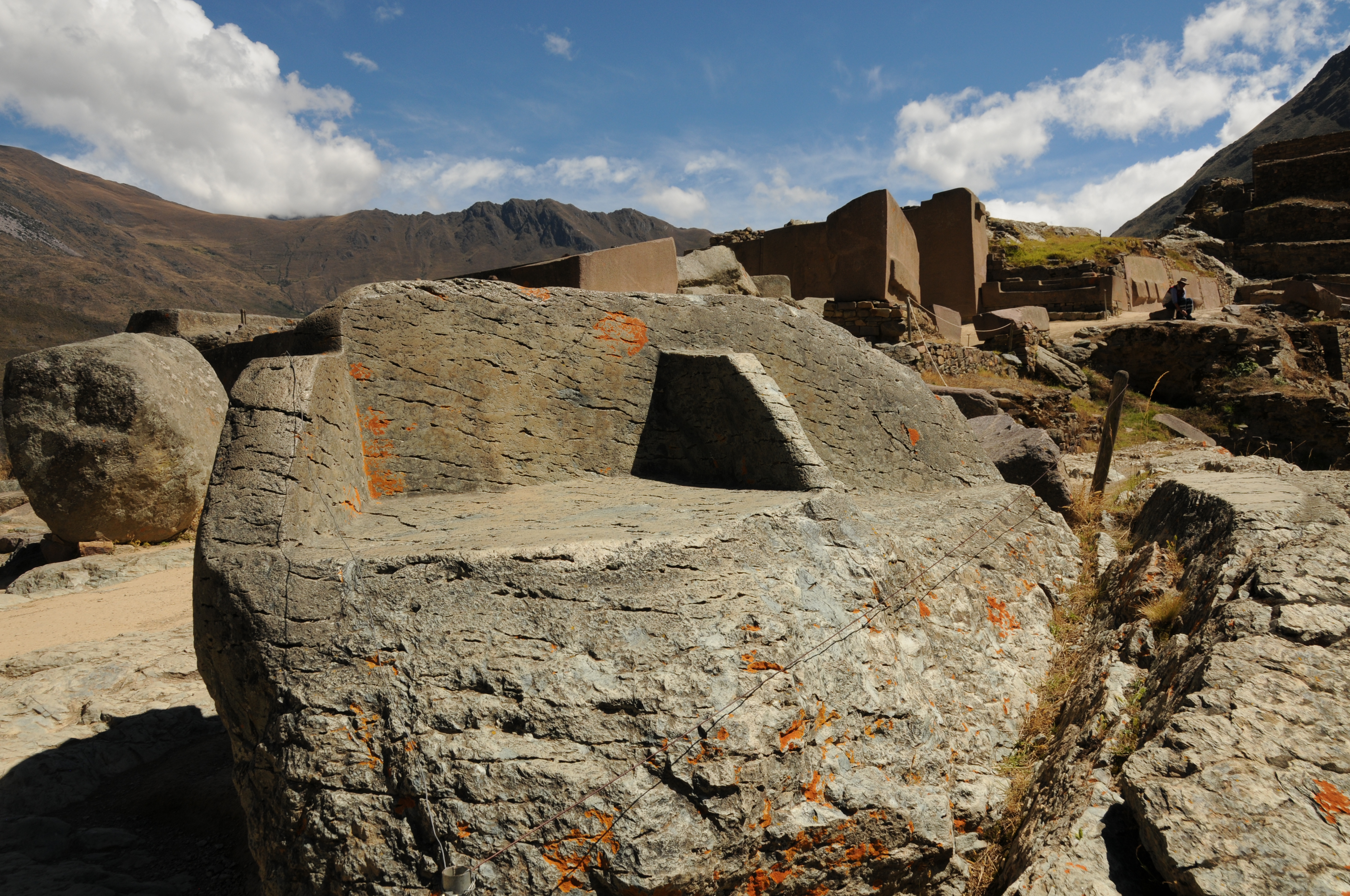
Olantaytambo

Agricultural terraces
Agricultural terrace with fountains in background
Location of fountains
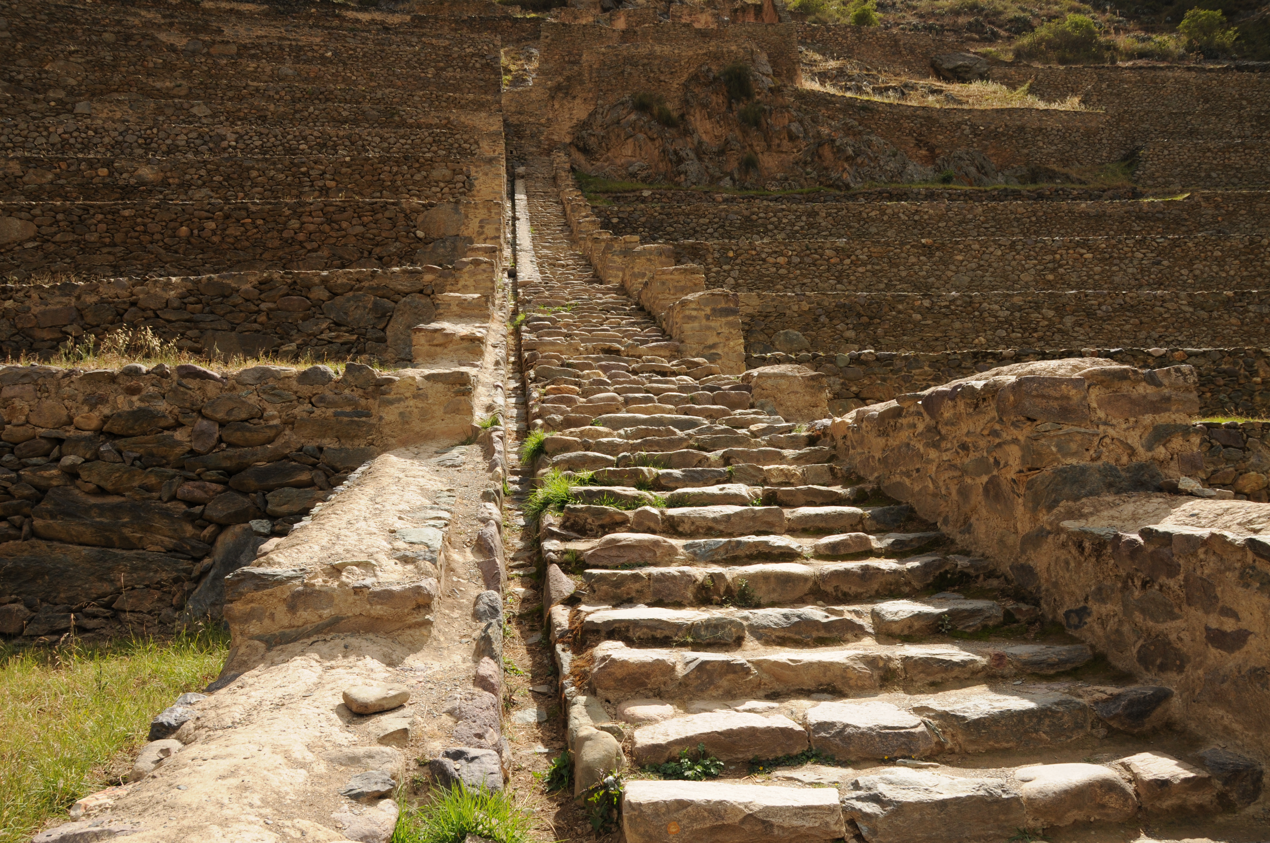
Drainage channel along steep steps


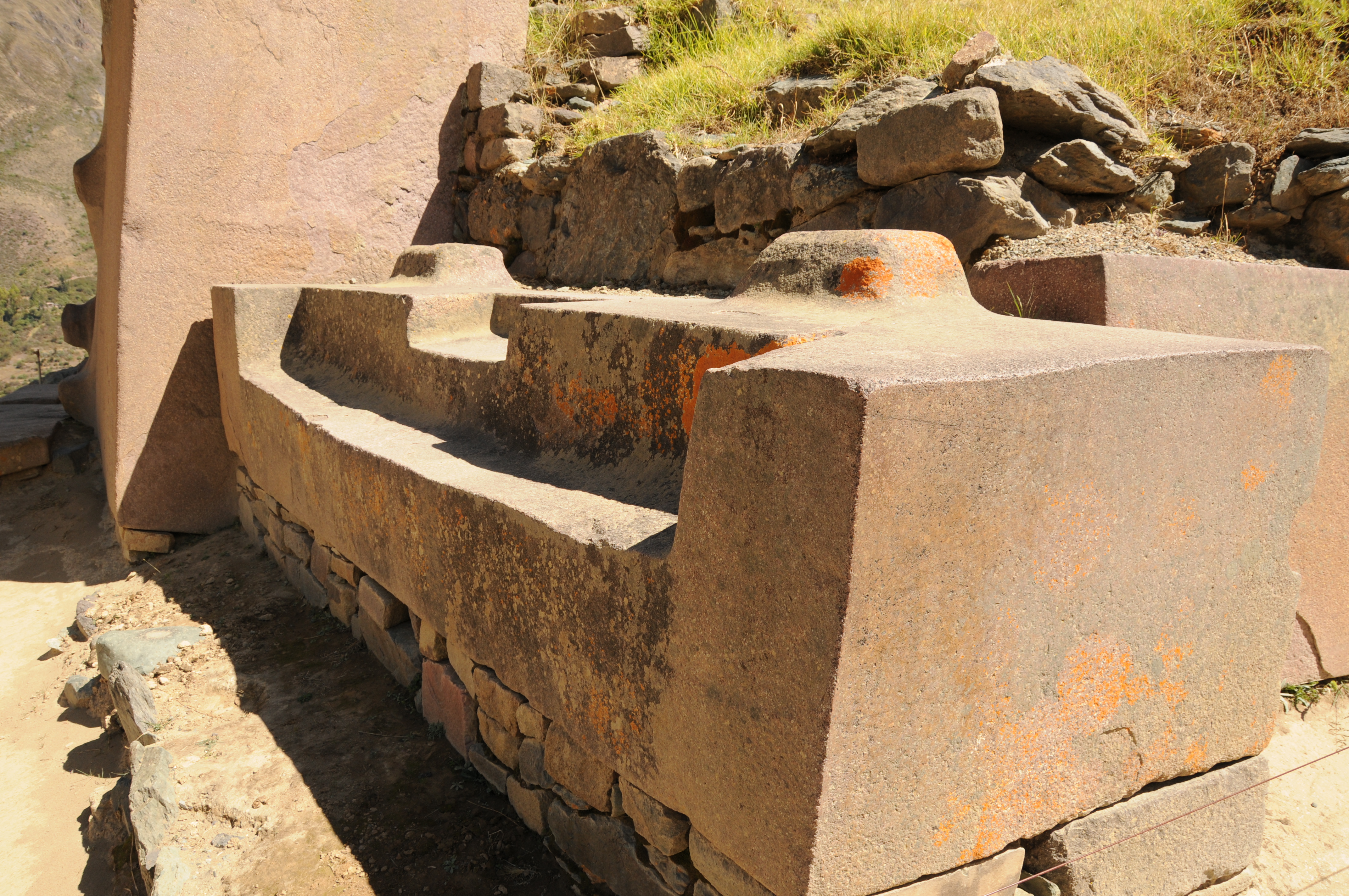
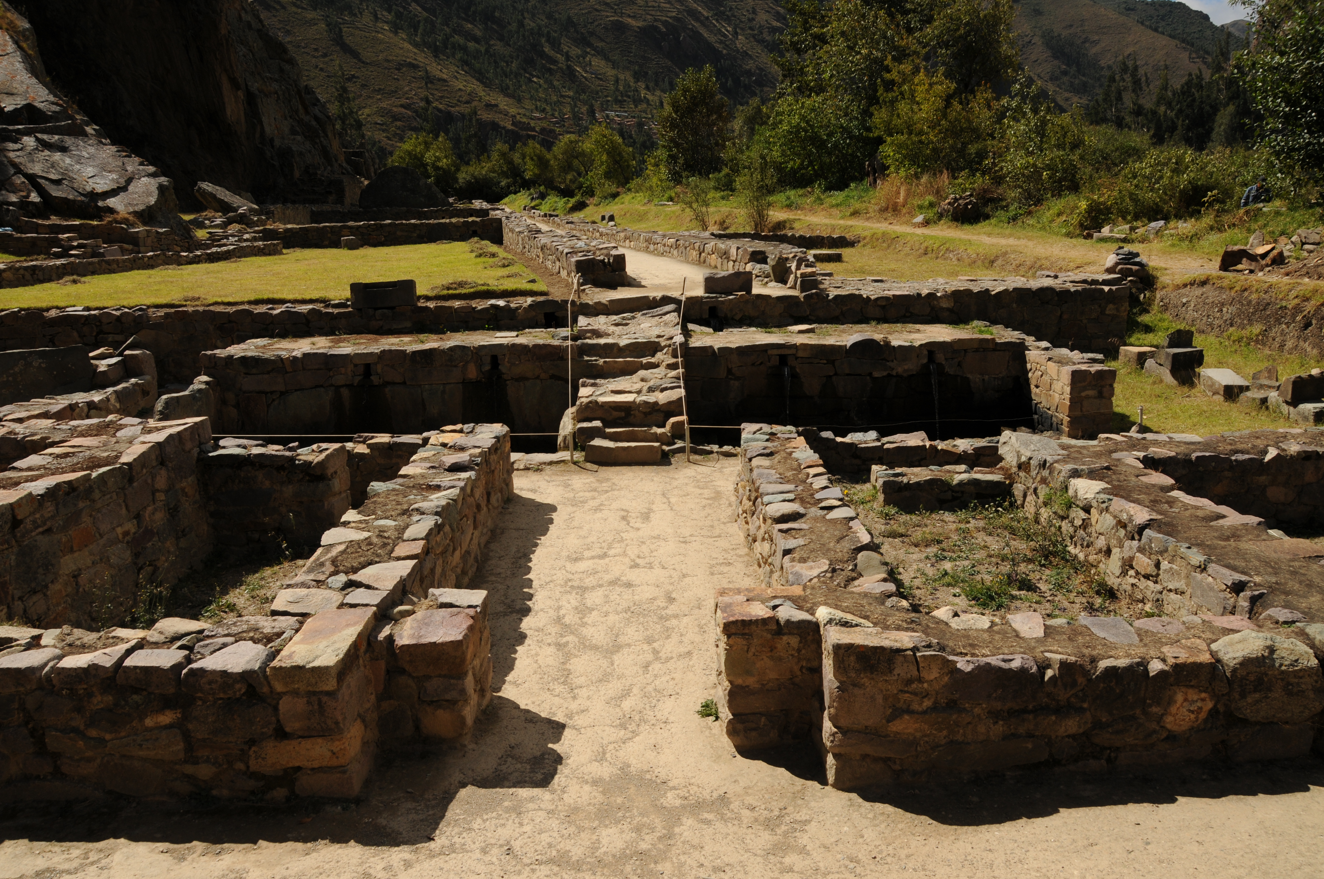
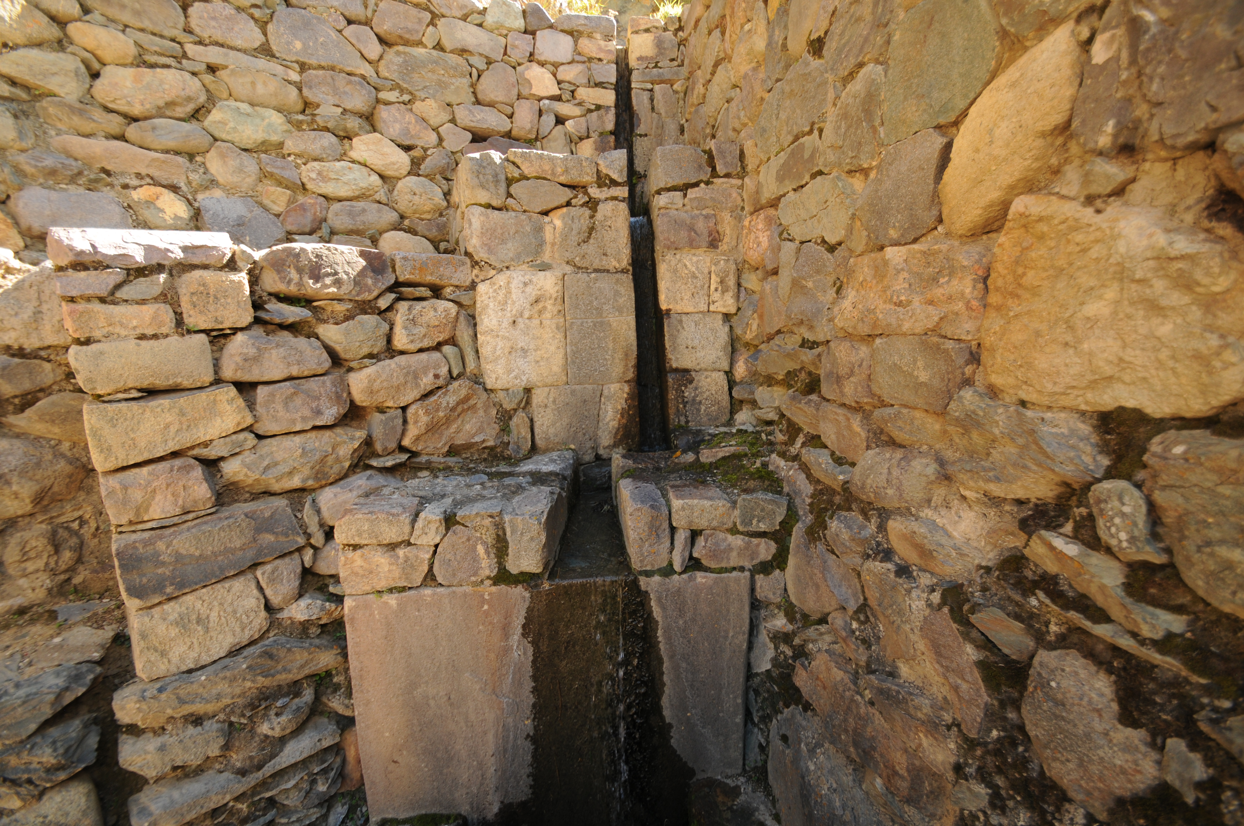
Fountains

Close up of two of the fountains
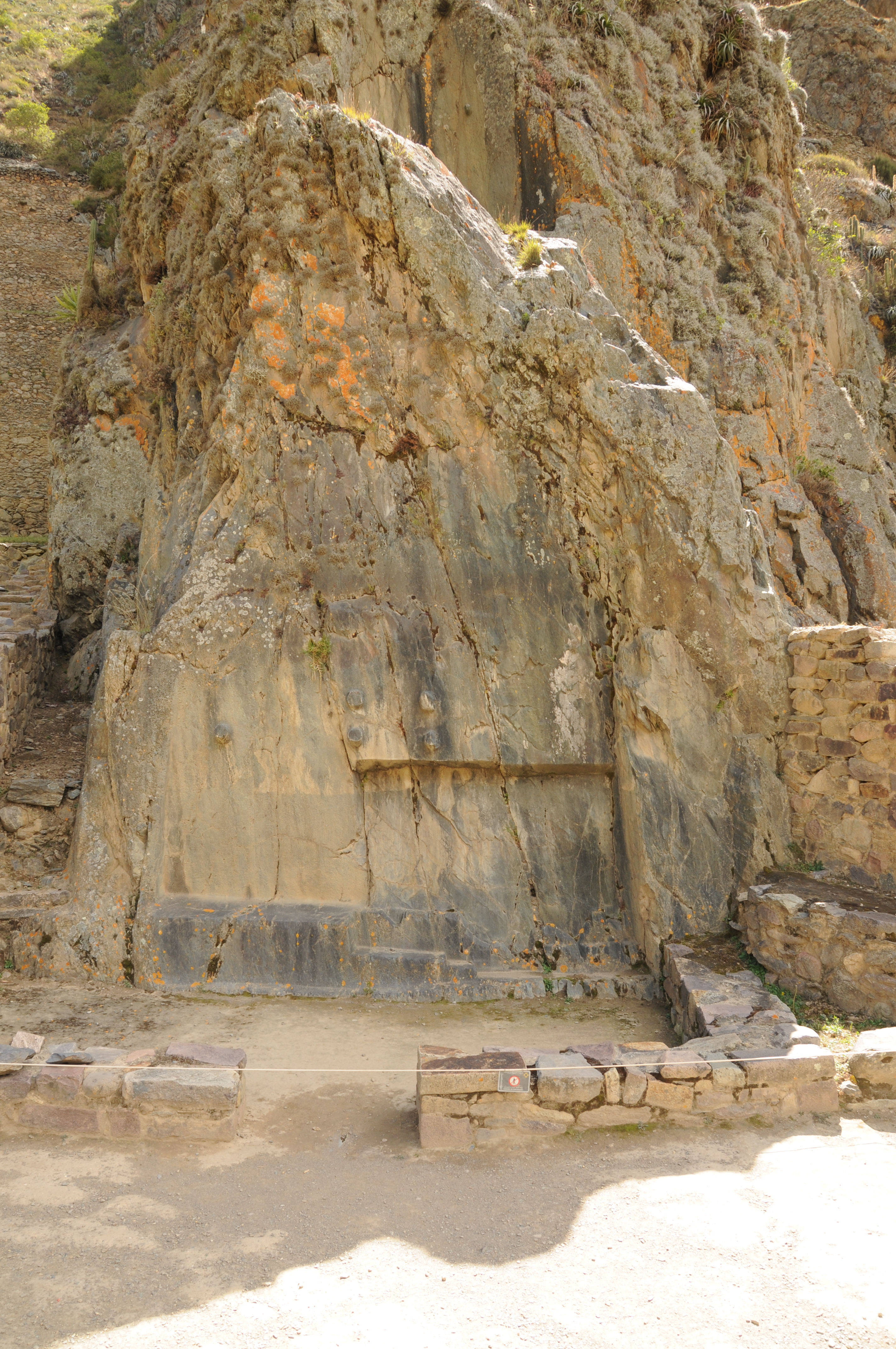
Inticchuariana observatory used to determine summer solstice. Place where one sees and understands the sun.

Fountains and terraces
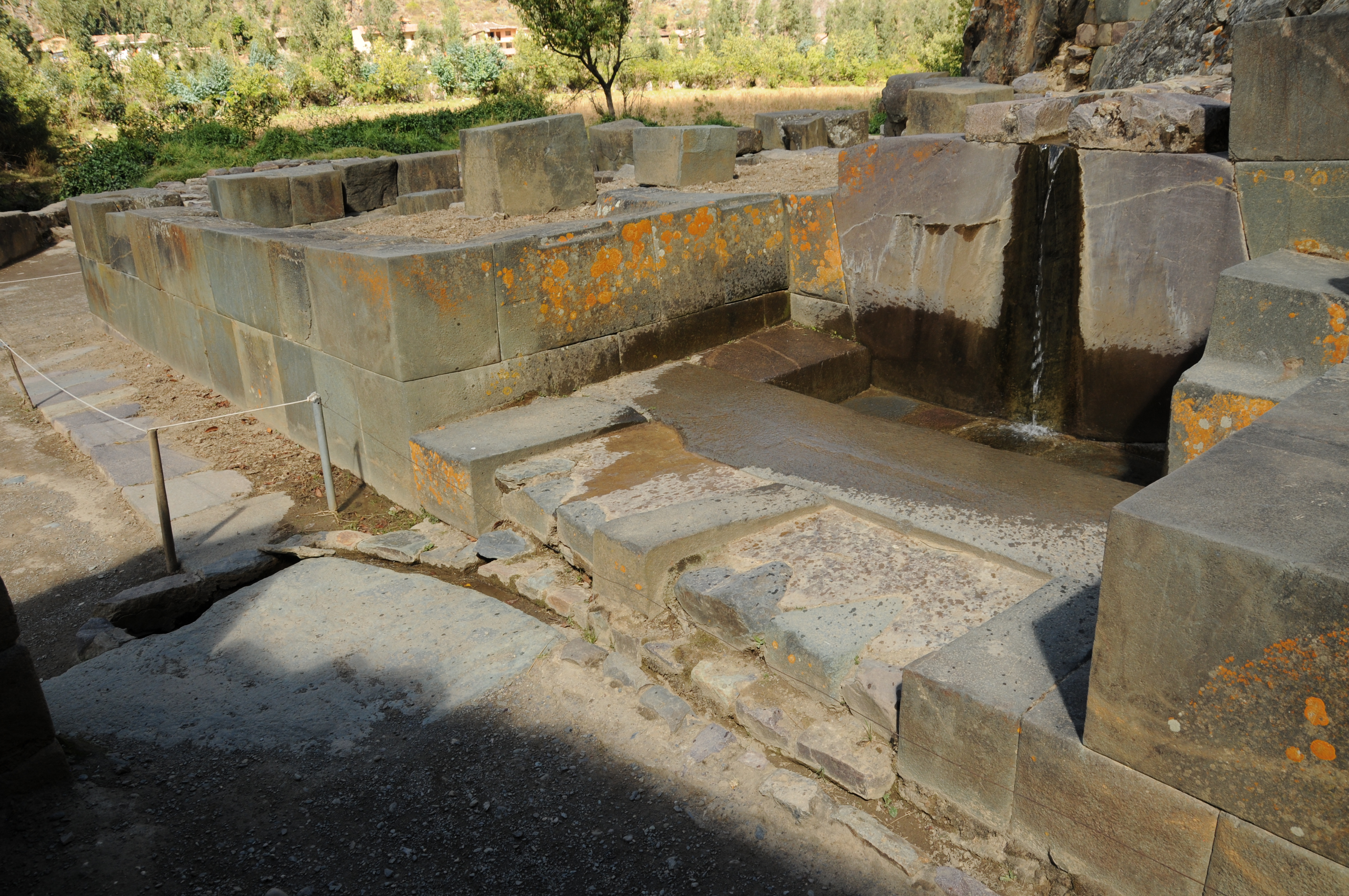
Fountain

Fountain

Building is the enclosure for the worship of water.

Fountain inside building


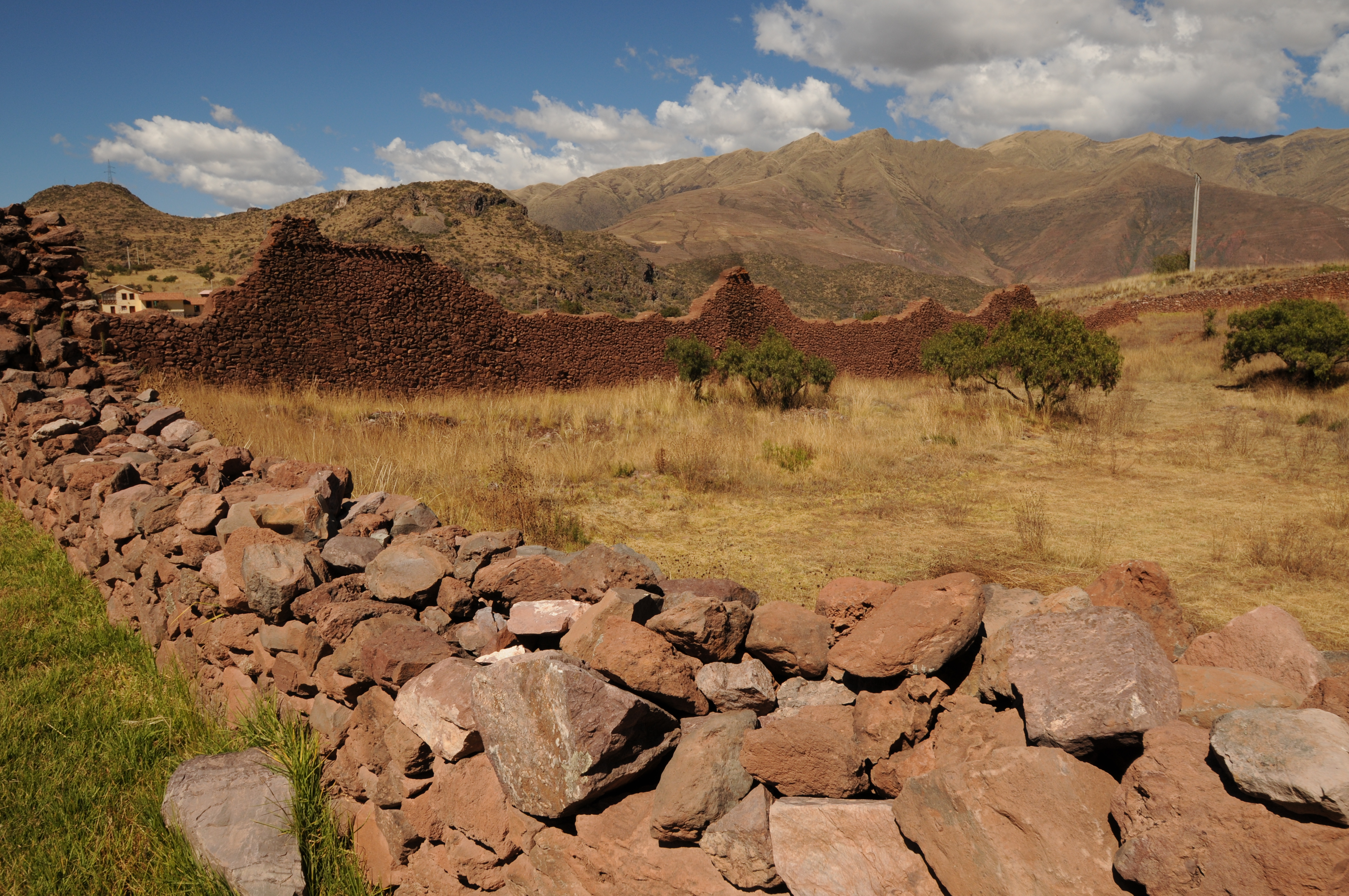
Puca Pucara
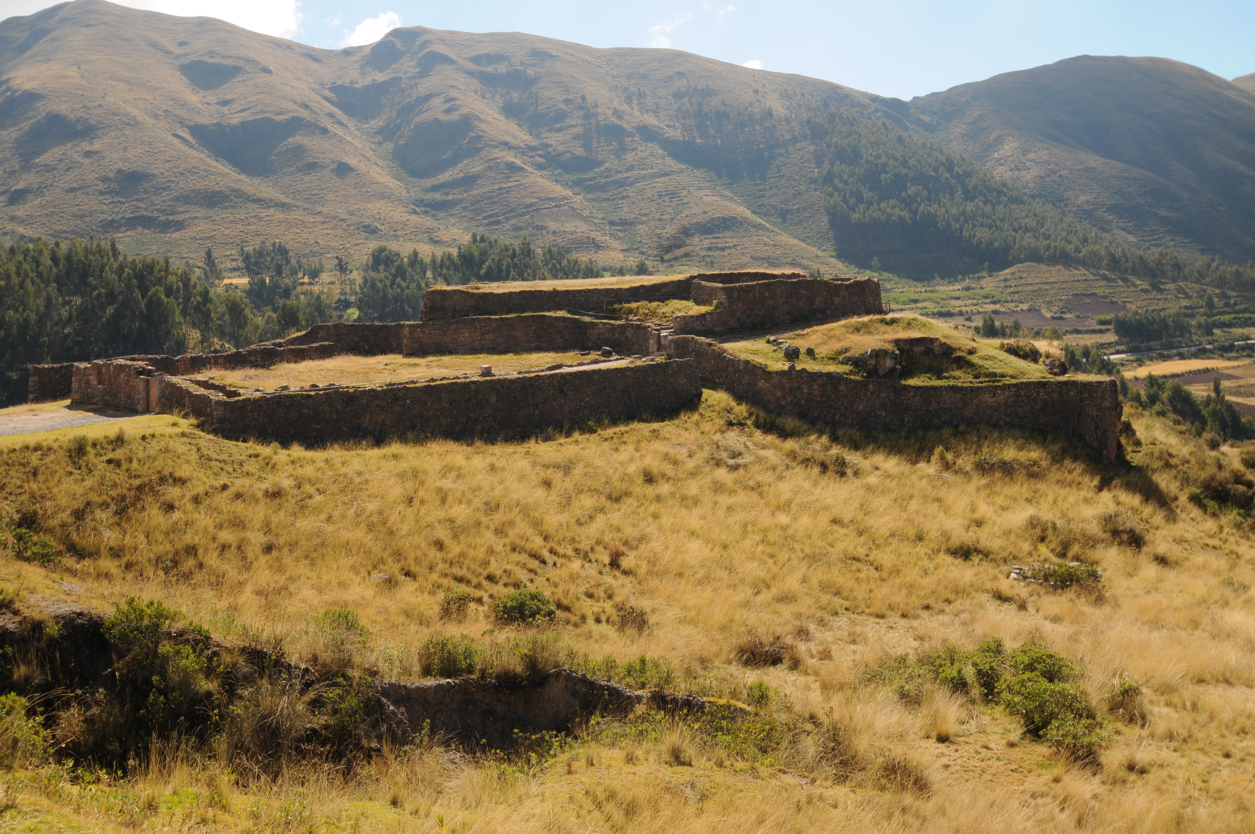

Fountain showing two channels leading from fountain.

Sacsayhuaman
Fountain

Fountain

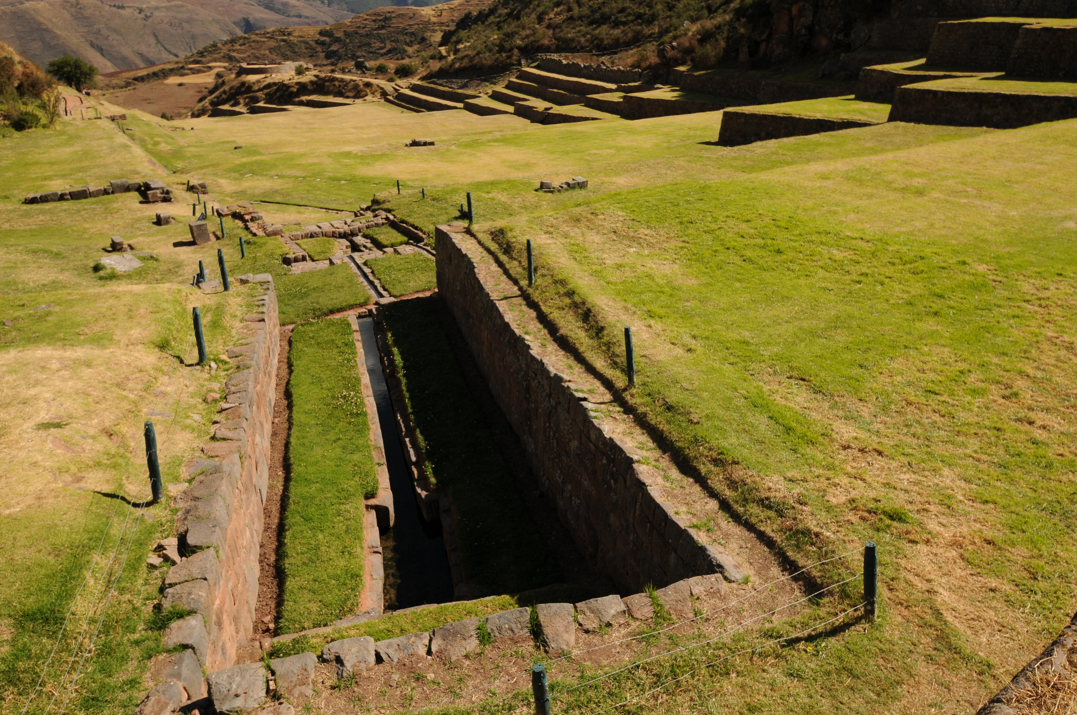
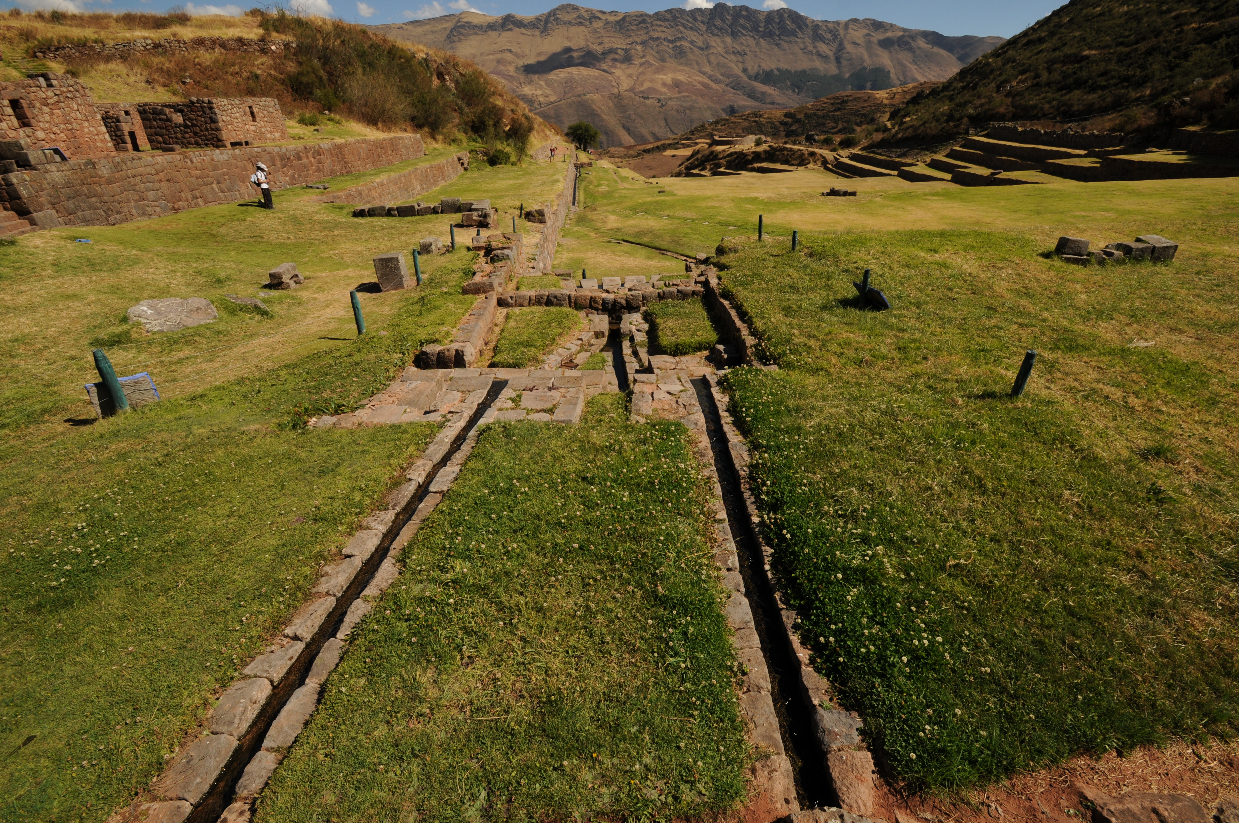
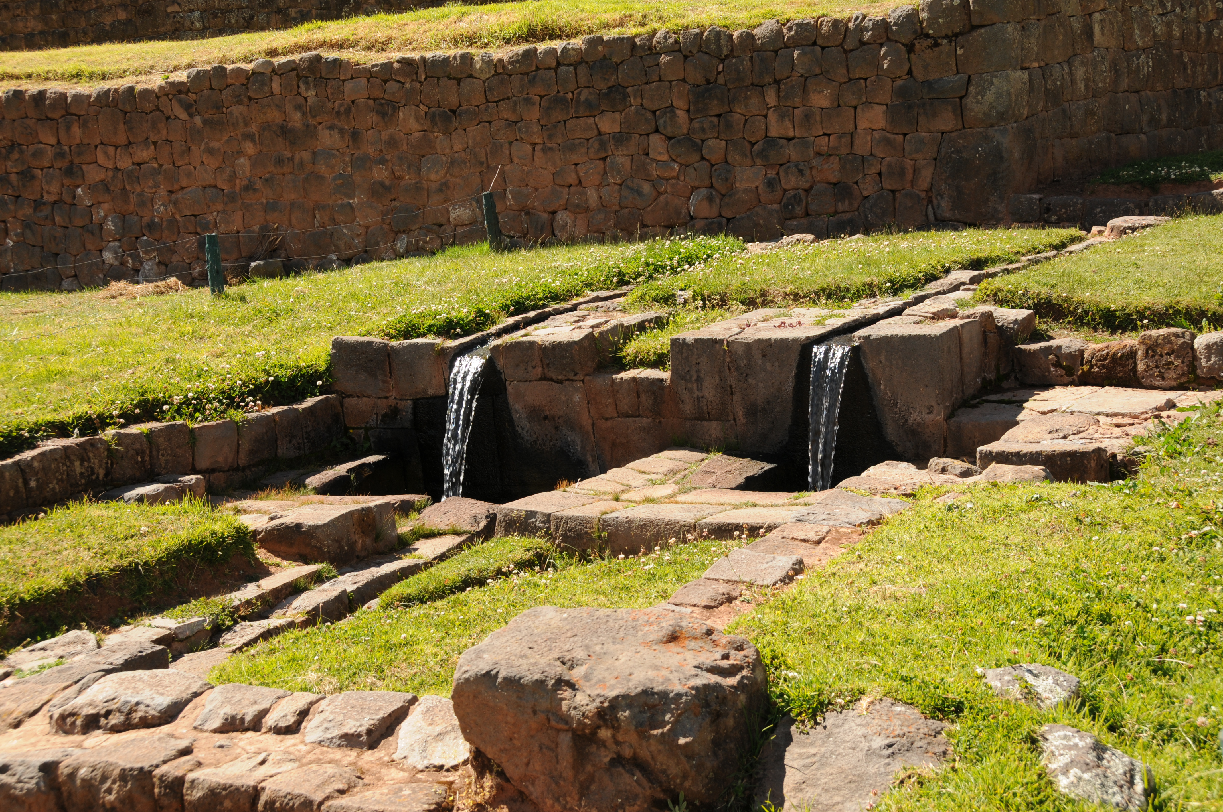
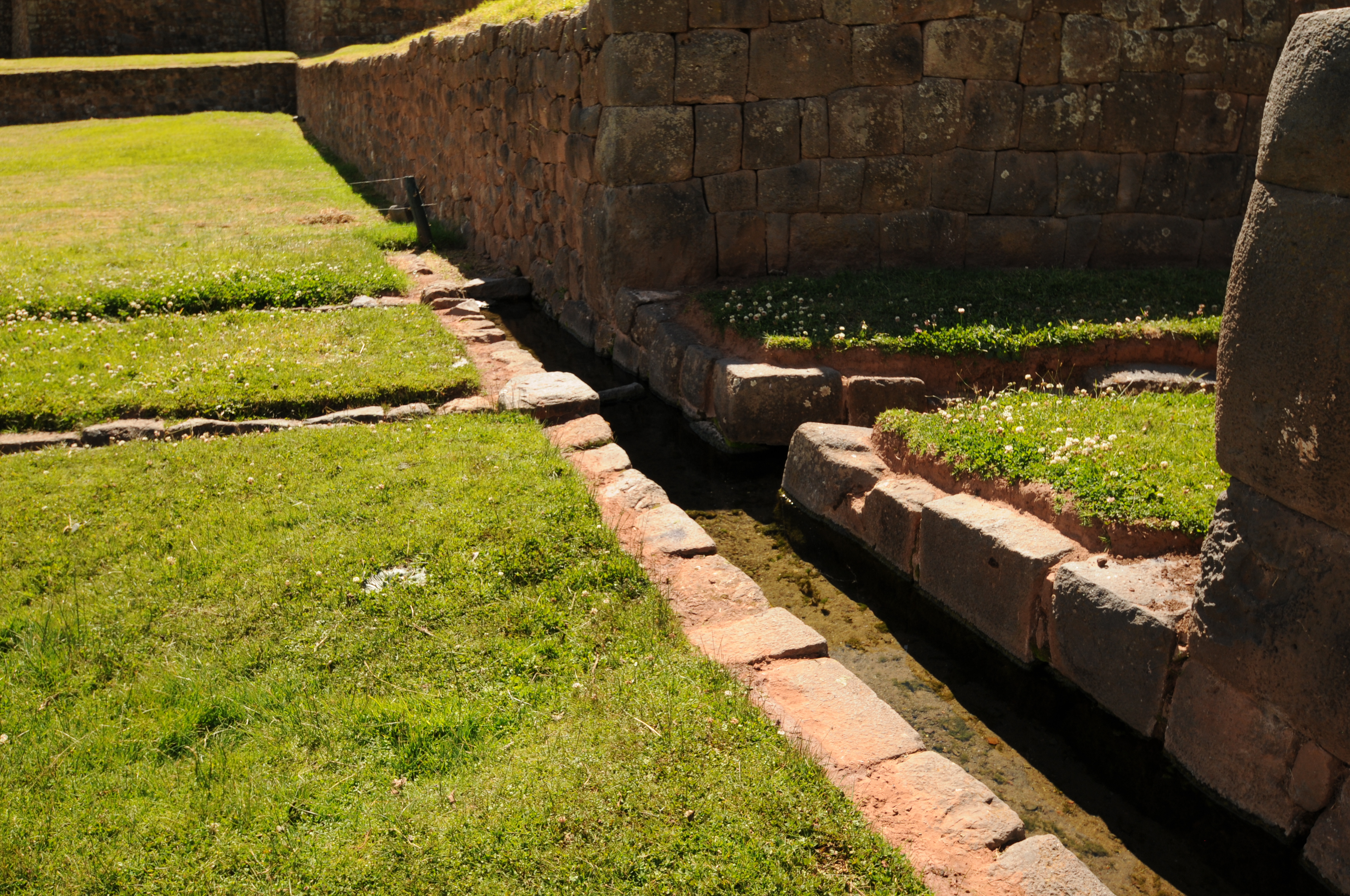
Qenqo


Moray
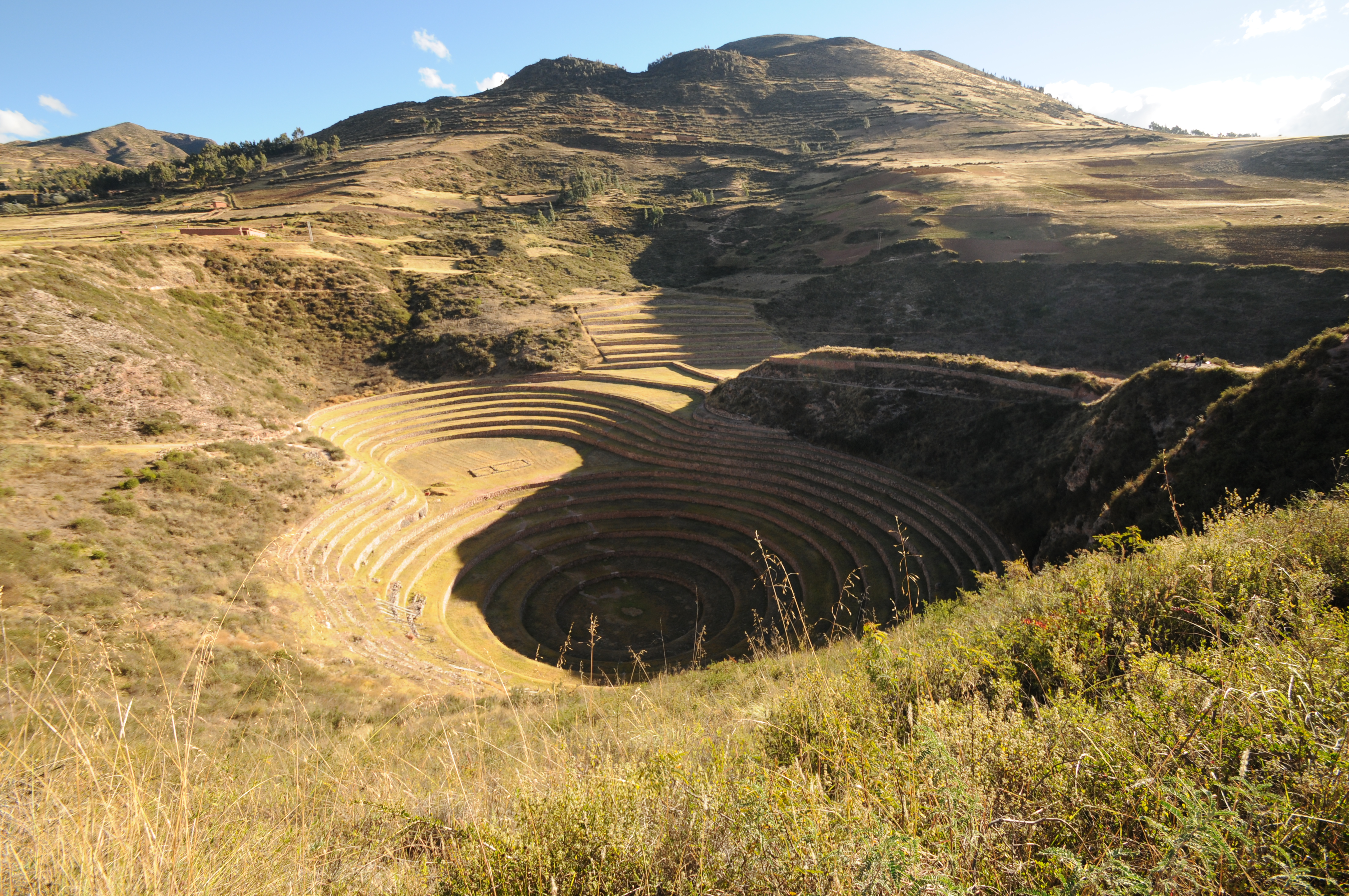
Moray is one of the most interesting of the agricultural areas as the Inca took advantage natural depressions constructing concentric terraces in the depressions. Above is a succession of ceremonial fountains in the largest of three terrace complexes. Moray in essence was an environmental/agricultural laboratory.
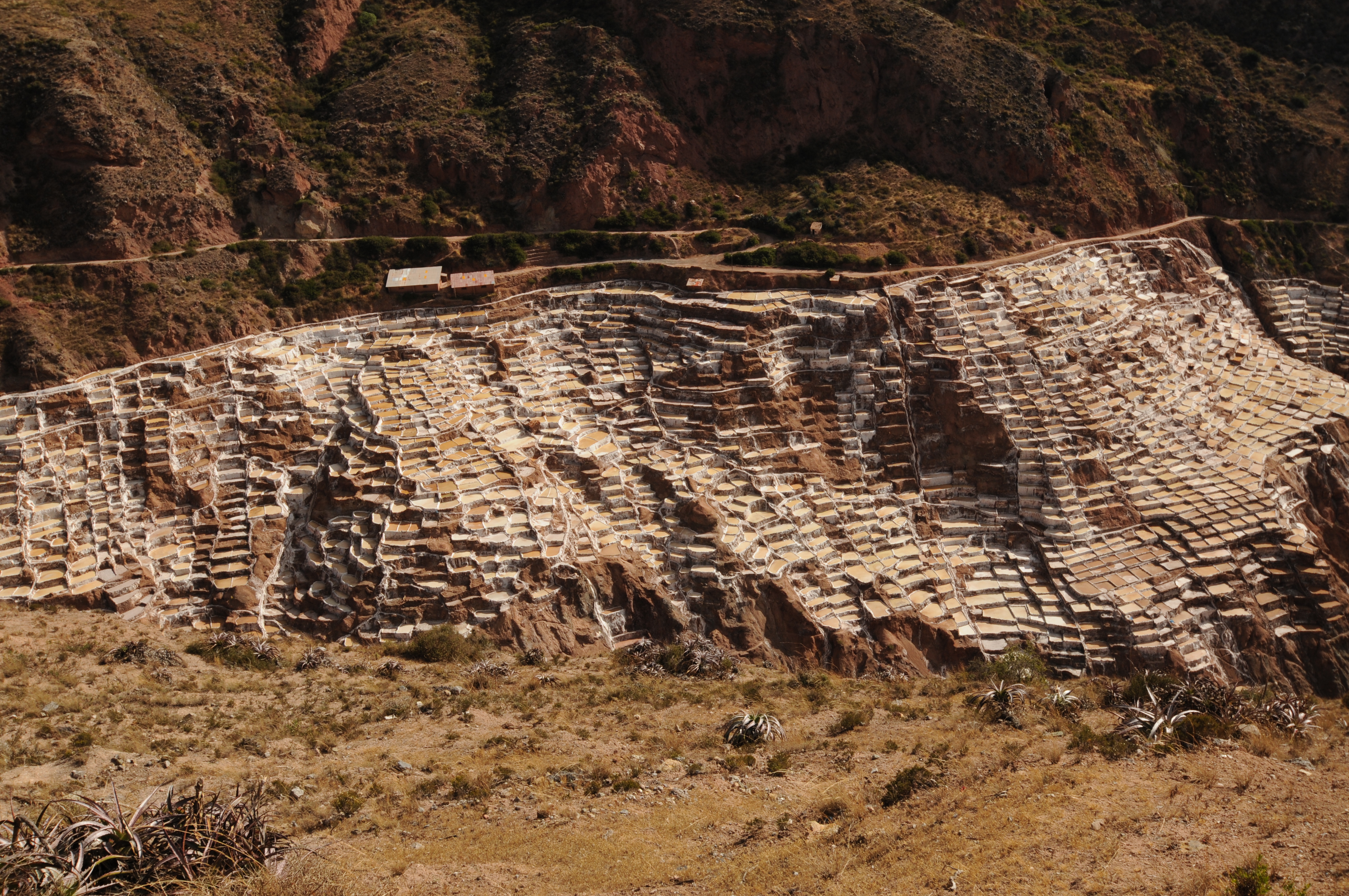
Salt mines of Maras
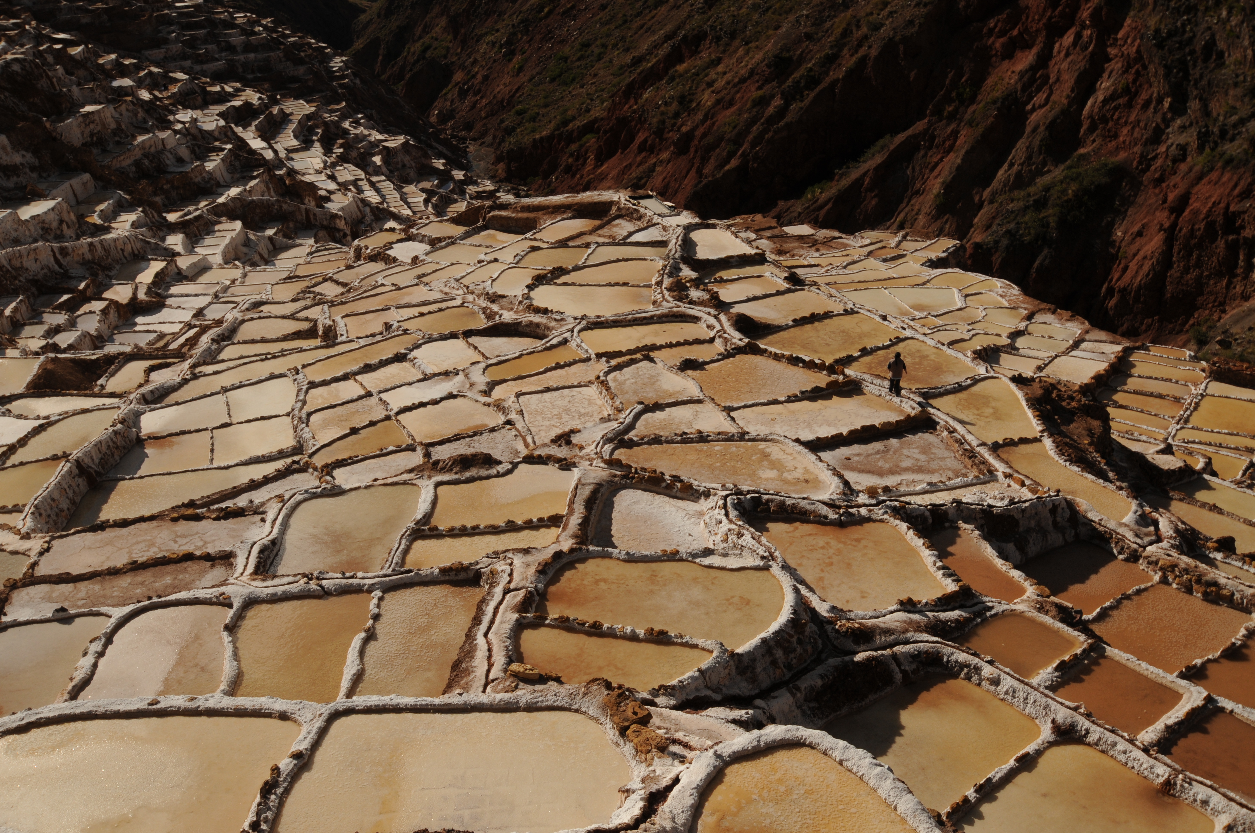
Salt mines of Maras
Chinchero


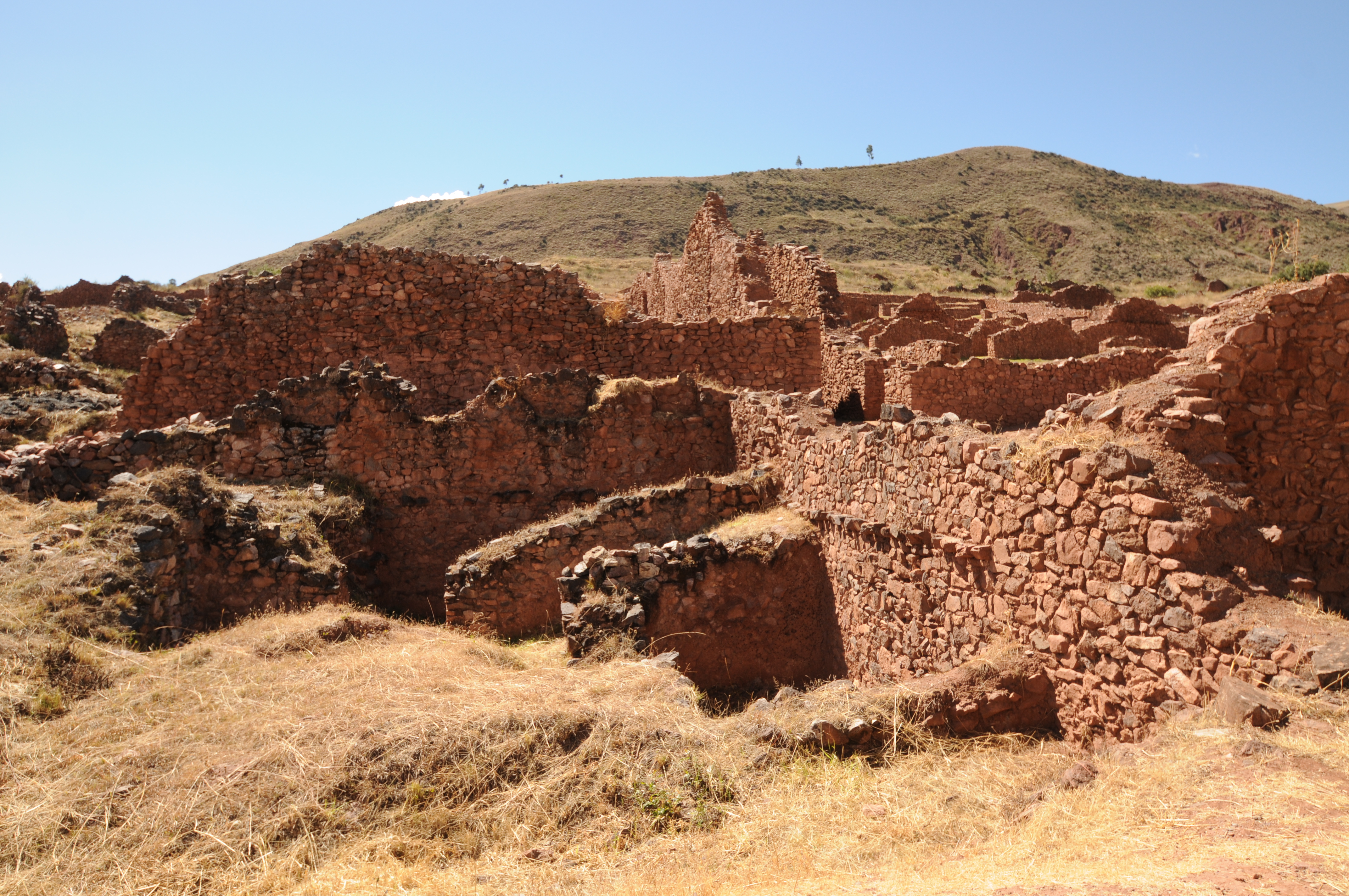
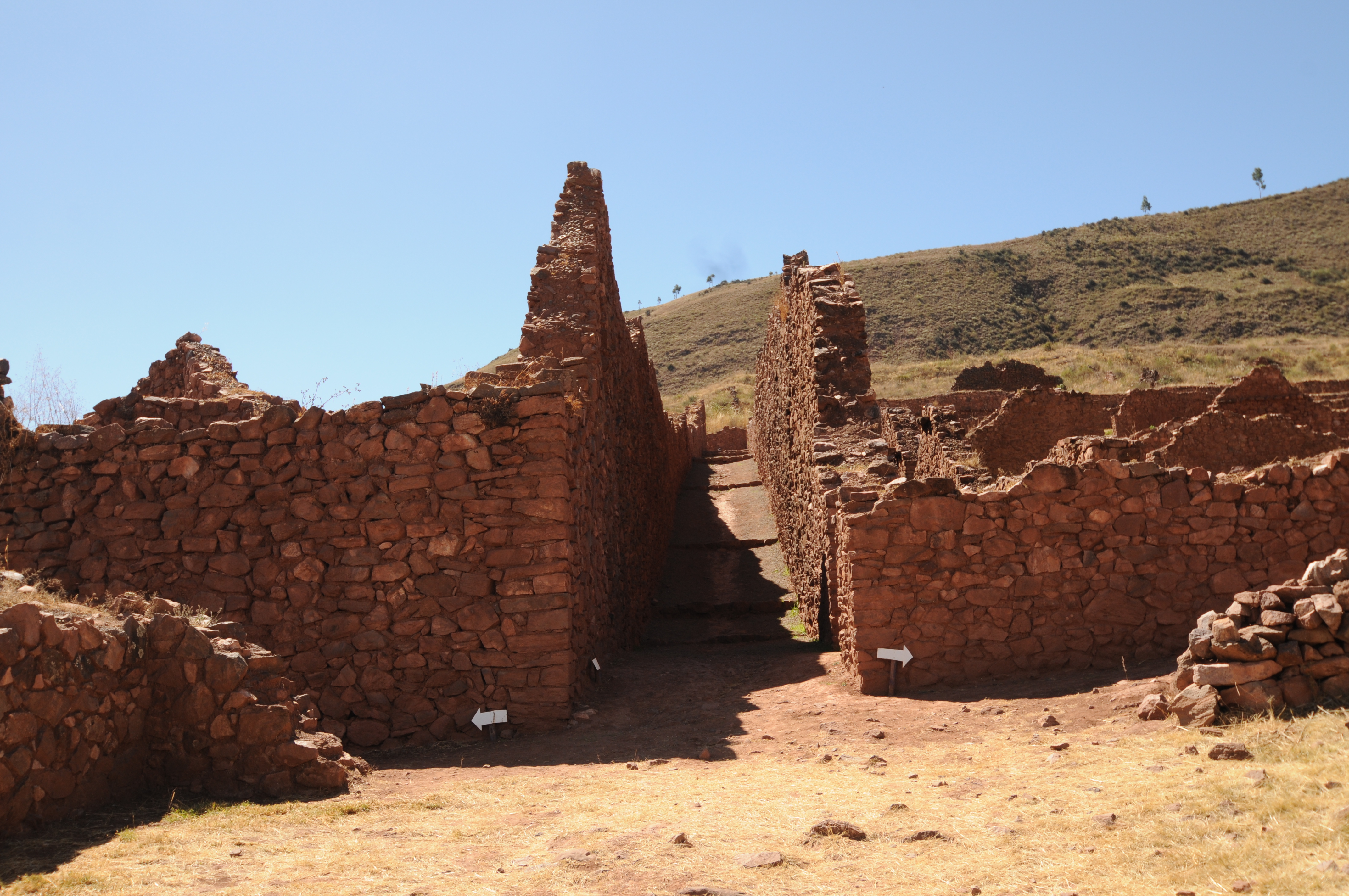
Pre-Inca


Excellent photographs for institutional memory and posterity.
Thank you for these amazing pictures!
Thank you very much Alisa for your kind words and interest.
amazing research and documentation
Wonderful photos that provide great sense of each site, along with your intermittent descriptions. Thank you for doing such a fine job of capturing these important Inca (and pre-Inca) moments!